Right off the bat, I'd like to thank Christopher Stevenson for putting New Caledonia on my radar. He rode there in September 2015 with his brother in law, and came back singing high praises.
Unrelated to this, I started learning French on my phone that Christmas, using duolingo. And, I'm married to a Mongolian, for whom coast-line is still a remarkable thing, despite living in New Zealand for the best part of 15 years.
An Air New Zealand sale came and went, but, after spending a few weeks regretting not pouncing, I scoped out the dates of the mid-trimester break, and was ready to pull the trigger when the inevitable "Islands on Sale" email arrived in my Inbox.
Trip on.
My job as Associate Dean of Students for a faculty with over 5000 of them is, not-surprisingly, very stressful at times. Stress affects my level of patience, and when I realised I was getting unduly snappy at home, a self-imposed exile was in order.
I took a couple of days' annual leave, and caught the train over to Carterton. Until Sarah arrived the following evening, I dipped in-and-out of work email and other tasks, and out-and-in to research on the road network of New Caledonia.
With my prior being that everyone knew what Chris had passed on, I was surprised to find a dearth of the sort of trip reports you might find here. Notable exceptions were both penned by Bruce Ashley, and included a magazine-style account which is motivational, has a few suggestions, but is short on detail, and a more comprehensive account of a traditional cycle tour, which had some great photos and description of the route they took, and what they saw. Chris himself had emailed me his route, including a lament that they didn't spend enough time on the bike before heading to Nouméa.
All good tips.
La Grande Terre, or the main island of New Caledonia, is long and thin. Based on what I'd read, and a fair bit of assumption, I figured the spine would be hilly (and therefore great riding). Bruce had also noted: "It’s best to go with the flow of the prevailing south-easterly trade winds that blow for four days out of five and carry you north along the coast" - the sort of comment no discerning trip-planner should ignore.
As the day wore on, my frustrations at the paucity of information grew. But, each time I turned my back on the office, I made a wee bit of progress - perhaps finding accommodation in a convenient place, an OK map, or a couple of towns with the right sort of distance between them.
A bus timetable eluded me for a long while. Searching for "New Caledonia bus timetable" or variations on the theme, were not fruitful. The inter-city bus company, RAI, had a website, but then (and now), it read: "Site en cours de construction. Pour connaitre les horaires des bus, appelez notre n° vert." My French was more than up to the task of knowing that was bad news, and I'm phone averse at the best of times (i.e. even when speaking in my mother tongue).
My breakthrough was searching in French, which quickly netted me this pdf. Although I'd been browsing the various Office du Tourisme sites, google looks more carefully, I guess.
Plan A wasn't great, I decided, after coming up with what felt like a better alternative. I was happy with the roads, with the exception of a connection which appeared on a couple of maps, but not all. We would also be somewhat dependent on the bus timetable being correct, and, I realised, I was heading into Bruce's tailwind.
Plan B not only resolved those issues, but pulled in what I imagined to be better roads too, as follows:
I played around with the Strava mapping tool, getting distances and amounts of climbing. The second day would be a challenge (190km and close to 3000vm), but we'd be fresh. The bus trips were both first thing in the day, and I liked the thought that we'd be able to get advice from the accommodation staff the night before on the wheres and hows of things. We were spending little time on RT1 - Route Territorial 1 - the main highway on the west coast, and we'd have a scorching tailwind on all the coastal sections!
I'd printed off a map of the island, and after marking it up with a highlighter, stared at it long and hard, and with my rogainer's hat on, tried hard to spot faults or better options. It stood the test of time, and it was on to accommodation booking.
Hienghène was a doddle, thanks to Hotel Koulnoue Village being listed on booking.com. That was duly locked and loaded, much to Sarah's delight. Monitel was also relatively simple to organise in Koumac, with a convenient online booking form. La Foa and Bourail were proving elusive though, but after a few unanswered emails, and the passing of a week or so, we confirmed Motel Allamanda in Bourail, and an Airbnb a few kilometres outside of La Foa.
In the end, there was little to do for about a month, aside from a bit of tinkering with bike setup.
My gear list is tried and true (well it suits me, at least). Despite having a couple of excellent Revelate bags, I wanted a bit more capacity than the Pika affords. Rather than buy a second Viscacha, I thought I'd give the Terrapin a whirl, and indeed it proved to be an excellent purchase. I can't recommend these bags highly enough.
Stealth Bike Bags whipped me up a custom frame bag, and it took me a couple of stabs to temporarily lower the bottle cages to make space for the bag, and a couple of 900mL bottles: a Wolf Tooth B-Rad Mounting base (locally sourced), and a Shimano gadget, designed on account of their Di2 batteries sometimes being in the way, but also potentially handy for bikepackers. The Wolf Tooth options are way more versatile, but you also pay a premium for quality...
Many words, photos and a few stats follow, with a range of purposes. To a large extent, they're for me - I get to relive the trip as I write, and to remind myself later of what I did and how I felt. But, it all concludes with a couple of maps, and some top tips. So, Ctrl-End if you want to head straight to the punchline.
Our flight out of Wellington was early, and we turned up for it with just a couple of (cardboard) bike boxes. His @ 20kg, and hers @ 15. We had our helmets with us as carry-on, and I had a small back-pack with a few bits and pieces we thought we might appreciate on the plane. Everything else was packed with the boxes, and aside from the boxes themselves, would be leaving Tontouta airport with us.
We didn't have much time in Auckland, but long enough that the transfer between the terminals was relatively stress free.
The international flight was not long - under three hours - and aside from some spectacular turbulence which had the flight attendants scurrying to get the food trolleys secured in the galley, the highlight was just before touchdown when we were able to see the spectacular colour contrasts between the open sea and the lagoon surrounding much of the island.
The boxes were waiting for us at the "Hors format" area in the baggage claim, and once out in the terminal, the assembly process began.
Once that was done, it was time for me to tackle one of the elements of the trip I'd been worrying about - stashing the boxes. The airport had no formal storage facility, but Chris had told me he'd (successfully) left his boxes with a cleaner.
I followed his lead, and soon had negotiated, in French, an arrangement with Myriam that I'd be back the following Saturday for them! She seemed delighted to help, and gave every indication that the 1000 Franc tip was both unnecessary, and appreciated.
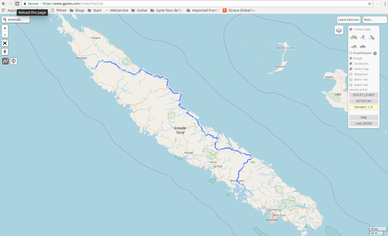
That having gone as well as we could've hoped, we made our way outside, and fired up our GPSs. I'd preloaded the New Caledonia base map onto both our units, downloaded from http://garmin.openstreetmap.nl/ and courses (route and elevation) via gpsies.com.
Immediately outside the airport was a supermarket, and it was a perfect place to fill our bottles, and, just because we were in "France", smash back the first of many baguettes.
RT1 was our only option for most of the ride to La Foa, but there were two instances where we usefully got off the main road for a while.
The first of these was immediately after Boulouparis, and started with a terribly rough patch of tarmac, in stark contrast to the smooth surface of RT1. After a few minutes jiggling along, we stopped for a wee, after which I was keen to head back to the highway. Luckily, Sarah had headed another 100m down the road for a bit of privacy, and when I joined her, noted we'd come to the end of the rough stuff, and we duly enjoyed the rest of the loop.
I was surprised by how dry everything was. I'd imagined a lush (and fairly steep) tropical island, but the countryside either side of RT1 was rolling, and very, very, dry.
The second diversion was about 10km before La Foa, and we made regular photo stops. Signage all became interesting, en Francais, and there were the usual unexpected sights one gets when riding a bike in an unfamiliar place. Nearing La Foa we had to make our ways past a large cow with a very funky pair of horns, and a slightly feisty spring to her step. I went first, and after making my dash for freedom, stopped to watch how Sarah got on. She made it look easy, and we were soon rolling in to La Foa.
We'd agreed to the dinner and breakfast package at the night's airbnb, and, had left NZ with 8 One Square Meal bars. So, we made do with a cold drink at the last supermarket for a while. We made a quick stop at the Office du Tourisme, scoring a handy paper copy of a road map.
Our digs were about 10km out of town, a great location given that it shortened the long ride planned for the following day by about the same amount. We made one bad turn, misinterpreting the owner's directions, but after a 5 minute climb and a 30 second descent (back-tracking), we were soon in the right place, and getting situated.
While my dealings with Myriam at the airport had been successful, I soon discovered that duolingo hadn't prepared me well for conversing. Our dinner was a "family affair", and my inability to translate Sarah's many questions, and understand and respond to the things our hosts were telling us, was frustrating, albeit not completely hopeless.
The meal was fantastic, and we gleaned most of the ingredients had come from the land, rather than the supermarket. Venison, "root" - possibly taro, papaya salad, and a stunning starfruit tart for dessert, were all delicious.
When we eventually turned in, I fired up duolingo, and one of the first things it asked me translate summed up the whole interaction nicely: Translate: "je suis une baleine". I could of course, not that it is something I would ever want to use on the street... We slept well.
Stats: 91km, 710vm climbed, one strava segment, one QOM for Sarah, 29 degree average, 34 degree max.
Day 2 - Farino to Bourail
We had a good breakfast, courtesy of our hosts. The leftover starfruit tart was a personal highlight! We rolled out soon after in a lovely, mild 16 degrees.
Unlike the previous day's riding through sunburnt pastures, we were instantly riding through mature trees. For a while, we climbed gently up-valley, but eventually we passed through a small settlement, and the road tipped up. In glorious fashion...
As we made our way up the 8km climb, we were treated to the occasional waterfall, view, beautiful gradient, and the ever-so-occasional car.
For the most part, the road surface was smooth and fast, but we there was one section that resembled a patchwork quilt of pothole repairs, something we'd see from time to time across the whole network.
At the top there were a couple of young locals who watched us silently as we took photos and grabbed a snack.
The descent was relatively steep in places, and Sarah didn't much enjoy the extra weight and the effort it demanded to keep the bike under control. We made a few stops to let her rims cool down a bit.
We passed many beautiful cemeteries over the week. The first one we passed seemed to have had little French influence, among other things, lacking the high wall that would prevent you seeing in. This style was much more reminiscent of those Megan and I occasionally passed on the Cape Epic.
There was much excitement when we reached the major turnoff south towards Canala and Thio. We went in the opposite direction, our enthusiasm tempered slightly by the rising temperature and the hills. We were soon down in a valley, and followed it towards the coast.
Rather than turn immediately north, we made a short detour to Kouaoua. Bruce Ashley's blog had noted how indistinct stores could be, and the supermarket here was no exception. Luckily there were a couple of customers parked outside, and a small banner alerting us to it. We grabbed a bottle of Orangina (more like lemonade plus orange juice than fanta), a baguette, and a couple of pains au chocolat, and headed down to the harbour for a picnic.
We'd read about mosquito-borne dengue fever and had packed some insect repellant. But, there was no sign of anything untoward at the beach, nor at any other point on the trip, and it remains unopened.
Not far from the beach was the terminus of an impressive conveyor belt which we'd first seen coming down out of the mountains on a very impressive bridge (it looked like a ski-jump, at first glance, and from far away had us guessing as to its purpose). Some 10-15km later, it ended in the middle of the harbour. It wasn't in use, and we were able to check it out first hand back at our turn off. The repressed (and unformed) civil engineer in me had a close look while Sarah powdered her nose.
Our hosts back in Farino had told us it hadn't rained there for a month. The river level was very low, and it did seem like a very smart time to build a new bridge!
The next river valley really hammered home the extent of the drought! Stunning, but probably not at all convenient for the locals.
The next climb was exposed, and hot, but luckily not too long! I'd grabbed Sarah's dry bag out of the Viscacha, and in gentlemanly fashion, had carried it up in my back-pack. The pack was largely brought with us for this purpose, though it was good to have it as carry-on, and should we need to do an epic supermarket shop could be deployed then too. Otherwise, it was stowed in the top bungy of my saddle bag, rolled up inside-out to keep all the straps out of harm's way.
I seem to cope with the heat well, though I dare say I'd be in big trouble if I became dehydrated, because sweating profusely (and keeping moving to maintain some wind chill) is a big part of the process. Sarah gets a very red face, and finds it quite unpleasant, so luckily found me waiting for her in a nice shady spot. And, once we got down into the next valley, she disappeared off into the river for a paddle and to drench her helmet.
A 600m climb beckoned. We'd bought some simple UHF radios from Dick Smith (online, and still in existence, apparently). We entertained one another by chattering away for the duration of the climb. We didn't use them much otherwise, but they took a bit of the stress out of getting separated on climbs or descents, and were fantastic in an urban environment too when not wanting to rely on cell-phone roaming or a local SIM.
It was clear why there was so much mining in these parts - the soil was a very deep red, presumably due to some useful mineral or other. A couple of wrecked cars rotting away in a ditch hinted at the cyclical nature of things...
As we neared the bottom of the descent, we passed through an active mine. Whereas speed differentials can be at times frustrating at home, on a tour like this they create great opportunities for staged photography.
We'd had good success at Kouaoua with regards shopping. Houaïlou got the same sized dot on the map, and we were in some need of a cold drink when we got there. Alarmingly, everything seemed closed up, but on the way out of town (just past the turnoff north to continue up the coast), was a gas station, which we made good use of.
Our return crossing of the island was nowhere near as hilly as the first had been, and consisted mostly of a 50km false flat followed by a couple of reasonable hills (topping out at about 400m).
We'd seen a lot of a couple of things on the ride, and we were treated to more of the same on this leg. The first was empty stalls by the side of the road. We'd hoped these would be stocked with delicious ripe fruit (well Sarah had, at least - fruit is too sticky for my liking), but aside from a few root vegetables or pumpkins, they were almost all empty. The second thing was car wrecks. These were strangely common, and just seemed to lie where they'd fallen: burnt, or crumpled, or just plain broken down.
The day had marched on, and by the time we crested the Col des Roussettes, it was time for lights on. Unfortunately this meant a few kilometres on RT1 in the dark, but we were sufficiently well lit, and the drivers sufficiently alert, that we arrived in Bourail with no incident.
The motel was at the end of town we'd entered, and the proprietor appeared in a car no sooner had we started sniffing around. We were soon cleaned up, and fed, courtesy of the supermarket on the main drag, and a snack restaurant which was open. There was no sign of the bus station, but we could deal with that matter after a good sleep.
Stats: 184km, 2720vm climbed, five strava segments, five QOMs for Sarah, 26 degree average, 38 degree max.
Day 3 - Koné to Koulnoue Village
As we neared the first major climb of the day, I watched in fascination as the temperature reading on my GPS went up and up. Only riding into some cloud cover prevented it from tipping into the 40s, which was just as well, because those clouds coincided perfectly with the hill.
We hung out for a while at the first summit at a very nice rest area, enjoying the views and some shade.
After a few short but savage lumps, we descended onto a bridge at the base of the last significant climb of the day. Sarah was in front of me, and blasted over the bridge, but I called her back, and minutes later we were both stripped down to shorts and enjoying some beautiful, cool and clear water over our skin. We probably spent about 15 minutes relaxing there, before getting reorganised and back to business.
I was becoming increasingly fascinated by how much variety there was in both the terrain, and associated bush. Despite the island being relatively small and us moving fairly slowly across it, things changed quickly. Gone were yesterday's barren and harsh landscapes - today we were being treated to plenty of jungle.
After the main descent, we followed a river towards the coast. I'd mapped a visit to Poindimié - an out-and-back which would have added 27km or thereabouts to our tally. The hot and somewhat hectic morning had us both running a bit low on gas, and while the supplies at the town would have been welcome, Touho was about the same distance away in the right direction, and we were both keen to knock off. Poindimié will keep and the store a Tuoho was indeed a mighty fine substitute!
The late start had us flicking lights on yet again, but we pulled into Hotel Koulnoue Village with no other troubles. After a shower, we discovered we were a little early for the buffet dinner, so made do with a cold glass of beer. Probably 95% of the beer I've had in the last couple of decades has been on cycle tours - the cool, savoury drink really slides down well in that context.
The dinner buffet was expensive, but had some great food (particularly sea-food salads) and the all-you-can-eat nature was handy. Our swanky bungalow was actually cheaper than the meal, but overall the costs were reasonable, and it sure beat trying to make to on supermarket fare.
Stats: 113km, 1465vm climbed, two strava segments, zero QOMs for Sarah, 29 degree average, 38 degree max.
After going crazy at the buffet breakfast, it was time to suit up and roll out.
It had rained heavily overnight, and while the roads were mostly dry, we could feel already that we'd face a day-long, new challenge - humidity. We had another unwelcome companion. Various cats and dogs seemed to be resident at the resort, and one dog decided he'd escort us to the gate, and then, the river, and then...
The increasingly annoying mutt was not deterred by other loose dogs that rushed out to investigate, nor a 50m climb. A stop-go man understood my plea that he grab the dog, but ignored it, smiling as if to say "good luck". After six excruciating kilometres, we were only able to get away from the bloody dog by virtue of the fact that he couldn't run fast enough downhill!!!
Fortunately, neither the dog nor his kin caused any lasting harm, so we rolled into Hienghène in good spirits. It was Tuesday morning, and a local market was in full swing. We rested our bikes against a handy wall and checked everything out. We were moderately tempted by some folded-paper flowers which would've made nice gifts for the girls. There were plenty of veges for sale, but also some seriously delicious-looking baked goods. Unfortunately though, our bellies were well and truly full, so we passed on everything.
... and looking forward to our next milestone a few kilometres up the road. It wasn't hot, but the humidity made it feel a lot warmer than the much higher, but drier, temps had felt the days prior.

Despite the humidity, it was nice to be riding on the coast. Up ahead, we could see, hitting the ocean, the major valley in which we would find La Ouaième, and the free 24/7 three-car ferry across it.
As luck would have it, we'd just missed it, so were able to enjoy watching it do its thing before our turn came and we were able to roll-on, roll-off ourselves.
The roadside stall we'd always imagined was waiting for us on the far side. Still somewhat overflowing from breakfast, rolled crêpes for 200 Francs were too good to pass by. There were simple cycle-tourist principles at stake too - given the uncertainty as to the next refuelling stop, its a risky business passing by food on offer.

I had a choice of "fraises" and "chocolat", and foolishly chose the former. The grass was almost certainly greener on the other side, but it felt good to finally partake in this aspect of New Caledonian life.
We'd occasionally pass locals walking along the road (or have cars pass us), and without exception, their faces would light up in response to our cries of "bonjour!". Boring vegetables had made way for trinkets in the stalls. Still not much use to us.
This was a stunning part of the island to ride through, and was much more what I'd imagined the island would be like. The hills were steep and bush-clad, and we were often treated to views of a large waterfall cascading down on route to the ocean.
Signage as we were leaving Hienghène had given us distances to Pouébo and Ouégoa. When we reached the former, we got to the far end without seeing a store, and given the fact we were both now ready for lunch, we turned around to try again. In the end we had to ask locals, and after inching forwards on the back of the previous person's advice (in French, spoken as if to someone fluent), we found ourselves about 500m off the main road, walking into a nondescript building and finding about a dozen people (all affluent, by their attire, and all white), tucking into a gourmet lunch.
Our hearts leapt, but we were soon informed that they'd reached their quota of servings for the day (20, if I'm not mistaken), and we were told we should have called ahead. They were good for a couple of cans of orangina though, and chilled water for our bottles. Better than nothing, but our OSM supplies were dwindling, and some proper food would have been nice.
In one of the sets of directions I'd been given, I'd caught mention of "the blue building" (in French), and lo and behold, about 100m down a side road was a store. Closed between 12:30 and 3pm from memory (or 12 and 3:30). C'est la vie...
I'd read about the Ouvanou Memorial, and managed to catch the brightly coloured tributes tucked away on the right hand side of the road. We stopped and paid our respects before continuing our ride.
We thought we'd hit pay-dirt a few minutes later, when we finally passed a stall with some ripe fruit. Unfortunately, this was in the form of two supermarket bags, labelled 500F and 600F respectively ($7-8 NZD), each sporting a huge bunch of ripe bananas. As peckish as we were, we didn't want 10 bananas each, just a couple, and nor did we want anyone chasing us down with a machete!
There was a chap tending his lawns across the road, so I hailed him, and we attempted to negotiate purchase of eight bananas from one of the bags. In hindsight, he may not have spoken French - he certainly showed no signs of understanding our requests for only eight, and he just kept pointing at the written price. We gave up, politely, leaving him to return to his lawns.
We passed a snack restaurant which was closed on Mondays and Tuesdays, but just as before we were to turn away from the coast, there was another snack restaurant which appeared out of the blue. Sarah had a "meat sandwich" while I had a chicken panini, and we both enjoyed an ice-cold orangina. It was not cheap food by any stretch, but it was delicious, and definitely filled a gap.
Before hitting the road again, we walked down a short track to the beach, and Sarah had a bit of a paddle to cool her feet down.
While the food was welcome, it meant we hit what was probably the worst hill of the tour with full tummies and cold legs. The 3km climb up to Col d'Amos averaged 10%, hitting almost 20% in places. It was a grovel, especially combining the unfortunate timing and our luggage. Sarah admitted to a tactical walk in one place, something I'd seriously considered myself.
Fearing a brake-burning descent, we were pleasantly surprised with the non-technical downhill, and we were soon turning off the main highway for a short diversion into Ouégoa. Aside from a glimpse of the town, we needn't have bothered. When we rejoined the highway about a kilometre from where we'd left it, there was a perfectly good (and open) mini-mart, but, we weren't to know, and after our struggles in Pouébo, were happy taking no chances.
The road through to Koumac was fairly taxing, with quite a few short and sharp climbs. It dawned on us that we were lucky to be riding these roads at all. There had clearly been a large bushfire in the area, and had it been in full swing, there's absolutely no way we would have got through. (We may have been able to bypass it with a 40km-odd diversion north of Ouégoa.) As it turns out, a week earlier, we'd have been royally screwed.
The last kilometres were sweet, especially for my cobber. We were peeling off some decent elevation, and she was firmly on my wheel. "This is a great tailwind", she shouted at one point, to which I replied "not for me!" and continued my toil into the headwind! But, better for knowing I was being useful.
We found Monitel without too much trouble, and were soon enjoying beer and pizza, just the sort of meal you can get away with at the end of a long day on the bike.
Stats: 147km, 1905vm climbed, two strava segments, two QOMs for Sarah, 26 degree average, 31 degree max.
We did ride our bikes, but only briefly. We had a couple of hours to waste before our 11:30 bus to Nouméa, so popped out to the Marina de Pandop, and rode from the bus station in central Nouméa to our hotel at the Baie des Citrons. Sarah inadvertently got a QOM on a small hill en route!
We did have some drama with the bus, on account of running our supply of low-denomination notes dry. The driver would not accept a 10,000F note for our 3,000F fare. Luckily, we had enough in change to get us to Bourail, whereupon we purchased tickets for the second half of the journey after buying lunch from the supermarket. Although a minor glitch, I fixated on it for much of the bus ride, despite it being a relatively cheap lesson (~1000F premium for buying the tickets in two chunks...).
I'd really been looking forward to this ride, and in many ways it was the one I enjoyed most of all.
The Lac de Yaté had been an obvious and interesting feature of the island, even before David Rowlands (who has raced the Tour of New Caledonia many times now) recommended the day's route to us.
What surprised me when I mapped it, was the fact that the lake was sitting at about 150 metres above sea level. It was a long ride when started from the edge of Nouméa, and it was even longer when including the ride to and from that side of the city from our accommodation. I hoped the rest day the day before, and the fact that we'd have no luggage, would compensate from the hefty (approx 180km) distance.
We began by following the waterfront promenade. It seemed to be a local roadie staple, and already in our short time in Nouméa we'd noticed bunches going up and down, up and down, up and down. A lovely road, but I think I would find it became tedious pretty quickly.
We were down to our last couple of OSMs, so we needed to make a supermarket stop before leaving town completely, in anticipation of no supplies thereafter. Despite the size of the supermarket, there wasn't a single banana in the place, so I made do with an apple for Sarah, and a couple of boxes of Nature Valley bars for our pockets.
We passed half a dozen more stores (and who knows how many bananas) before we made the left turn onto RP3 shortly after La Coulée, raiding the drinks fridge at one of them.
There were a couple of decent climbs before we finally dropped down to ride alongside the lake which is responsible for about 20% of the country's electricity (source: pecc.org). We found ourselves (hot and sweaty) in a very photogenic part of the country, and I enjoyed taking advantage of my riding buddy's presence. As much as I like photos of my bike with a stunning back drop, Sarah is a nicer alternative.
We'd both been rocking MTB shoes and these certainly helped when clambering up road cuttings.
We eventually passed the road we'd take back to Nouméa, and were soon heading along a dirt road to admire the dam. We had a good snack break there, and debated whether or not to make a visit to Yaté, as originally planned.
Sarah's enthusiasm had stayed up north, and unfortunately, we were about as far from home as we were going to get. The deviation to Yaté would have added about 350m of climbing, and since we were not in need of supplies, decided to ride forward only in the hope of decent views down to the coast.
As it turned out, we would have had to start the descent for the view (if any), so we called it quits and began the ride back to Nouméa. Not before soaking up elevated views of the lake, and the roads around it from a viewing point near the saddle.
I made my one and only driving error leaving the view point, spending a couple of seconds riding as if I was in New Zealand. Luckily, the road was narrow (and quiet), so the correction to the right side of the road (in both senses) was easy and without unfortunate repercussions.
Sarah's legs had followed her head, so I was forced to embark on an exercise aimed at restoring her head (and therefore, I hoped, her legs). There was something compelling about my attempts, and our paced picked up, bringing our ETA back into the "reasonable" category.
We were clearly passing through an area riddled with mountain bike trails. The trails themselves were not particularly evident (and there were no riders), but regularly we'd cross a bike "path" painted across the road. I was bemused that I could never quite make out what exactly these were connecting, but I assume the tracks were there.
We'd traded the river valleys and coastline from our previous rides, for massive basins, and it fascinated me both how vast the landscape felt, and how quickly we were traversing it.
Sarah was gagging for some fresh water to cool herself with, and it proved elusive for a long while. Eventually we found some, and it was a welcome respite for her. I fussily kept my feet dry.
Leaving the last major basin, we climbed up onto a ridge which featured some puny windmills...

... before plunging down the other side. Unlike the Col d'Amos, where we definitely drew the short straw in terms of direction of travel, we definitely wouldn't have enjoyed doing this bastard road upside down.
We were back in mining country, and though it wasn't as obvious as it had been on the drop into Poro, at some point we appeared to be moving through a working mine.
A road-side store was a welcome milestone just south of Mont-Dore. We refuelled there, and I decided discretion was the better part of valour and cut out the loop around Mont-Dore itself. On the plus side, it shortened our ride by 5km or so, but at the expense of a climb over the Col de Plum.
Fearing a scolding, I rode straight over the top, but waited for Sarah 250m down the other side. When she arrived, she told me she'd noticed some water fountains that she wanted to check out. When we got back to them, we found locals filling containers at taps, a la the Petone aquifer. We filled our own bottles, more out of principle than on account of thirst, and then resumed. (The next day, we noted bottled water at the supermarket from this very source.)
I'd mapped a return trip across Nouméa rather than taking the longer route around the foreshore. It was a disaster, and the promenade would have been not only more pleasant, but probably quicker too. Live and learn.
Stats: 177km, 2190vm climbed, 17 strava segments, 9 QOMs for Sarah, 25 degree average, 34 degree max.
Our flight back to NZ was at midday, so we booked a morning shuttle with Arc en Ciel. We were the first pick-up (of many), so despite the early collection, we didn't arrive at the airport until 10 or so.
Then began our long and nervous wait for the boxes to materialise. While we got them in the end, I'm not sure I'd want to subject myself to the stress again. We never did have to confront how Air NZ would have handled unboxed bikes, and we certainly had no time to organise alternatives if they didn't have them for sale, and insisted on them.
We had seen a multitude of bike stores on a walkabout the day before (all along or in the vicinity of Route du Porte Despointes). I dare say we'd have been able to source a couple of boxes from them, had we attempted to.
We never did see Myriam again, but thankfully we did see the boxes. I'd stripped front wheels and handlebars the night before, so they were pretty much ready to drop in, and we actually spent longer in the check-in queue than doing the boxing. Both a fraction of the nervous wait, though.
Her note was totally effective though, it's just that the folk at the counter didn't know where to find them. It felt like a bullet-dodged, but it's possibly a perfectly reliable strategy...
We'd covered just shy of 750km and climbed 9000vm, with an unexpected, yet glorious, range of environments. We'd been reasonably lucky with supplies en route, but the OSMs from home had been a sensible call. We hadn't used the water purifier (nor did we drink from streams), and almost all of our spare clothing had been unused (rainwear and warm clothes particularly). The backpack, jandals and radios (none of which I'd have had if alone) were spot on. The frame-bag had been an excellent store for the bike-related bits (tubes, tools etc), while a Revelate Gas-tank sitting on Sarah's top tube had been a good place to keep our lotions and potions (sun-cream, Sweet Cheeks Butt Butter - don't leave home without it, hand sanitiser, lip balm). The Revelate saddle bags are a magnificent bit of kit, and performed true to form. The closest we came to a bike problem was Sarah dropping her chain once.
Sarah was a wonderful riding partner. The radios helped at times, but it was her incredible strength and fitness that made our ambitious ride possible. The four days on the road were consistently harmonious, and tensions flared only once the riding had become optional (and the beach beckoned). We will be riding together again soon, no doubt.
I promised some top tips - these a mix of New Caledonia specific things and minor revelations which I don't want to forget and might as well pass on.
Unrelated to this, I started learning French on my phone that Christmas, using duolingo. And, I'm married to a Mongolian, for whom coast-line is still a remarkable thing, despite living in New Zealand for the best part of 15 years.
An Air New Zealand sale came and went, but, after spending a few weeks regretting not pouncing, I scoped out the dates of the mid-trimester break, and was ready to pull the trigger when the inevitable "Islands on Sale" email arrived in my Inbox.
Trip on.
The planning
My job as Associate Dean of Students for a faculty with over 5000 of them is, not-surprisingly, very stressful at times. Stress affects my level of patience, and when I realised I was getting unduly snappy at home, a self-imposed exile was in order.
I took a couple of days' annual leave, and caught the train over to Carterton. Until Sarah arrived the following evening, I dipped in-and-out of work email and other tasks, and out-and-in to research on the road network of New Caledonia.
With my prior being that everyone knew what Chris had passed on, I was surprised to find a dearth of the sort of trip reports you might find here. Notable exceptions were both penned by Bruce Ashley, and included a magazine-style account which is motivational, has a few suggestions, but is short on detail, and a more comprehensive account of a traditional cycle tour, which had some great photos and description of the route they took, and what they saw. Chris himself had emailed me his route, including a lament that they didn't spend enough time on the bike before heading to Nouméa.
All good tips.
La Grande Terre, or the main island of New Caledonia, is long and thin. Based on what I'd read, and a fair bit of assumption, I figured the spine would be hilly (and therefore great riding). Bruce had also noted: "It’s best to go with the flow of the prevailing south-easterly trade winds that blow for four days out of five and carry you north along the coast" - the sort of comment no discerning trip-planner should ignore.
As the day wore on, my frustrations at the paucity of information grew. But, each time I turned my back on the office, I made a wee bit of progress - perhaps finding accommodation in a convenient place, an OK map, or a couple of towns with the right sort of distance between them.
A bus timetable eluded me for a long while. Searching for "New Caledonia bus timetable" or variations on the theme, were not fruitful. The inter-city bus company, RAI, had a website, but then (and now), it read: "Site en cours de construction. Pour connaitre les horaires des bus, appelez notre n° vert." My French was more than up to the task of knowing that was bad news, and I'm phone averse at the best of times (i.e. even when speaking in my mother tongue).
My breakthrough was searching in French, which quickly netted me this pdf. Although I'd been browsing the various Office du Tourisme sites, google looks more carefully, I guess.
Plan A wasn't great, I decided, after coming up with what felt like a better alternative. I was happy with the roads, with the exception of a connection which appeared on a couple of maps, but not all. We would also be somewhat dependent on the bus timetable being correct, and, I realised, I was heading into Bruce's tailwind.
Plan B not only resolved those issues, but pulled in what I imagined to be better roads too, as follows:
- Saturday, arrive midday, ride 80km to La Foa
- Sunday, cross the island, ride up the coast a bit, and cross back to Bourail. Hilly, and long...
- Monday, bus to Koné. Cross the island, and ride up the coast to Hienghène. Hilly then flat, with an optional out-and-back to Poindimié
- Tuesday, up the coast, then cross to Koumac
- Wednesday, bus to Nouméa
I played around with the Strava mapping tool, getting distances and amounts of climbing. The second day would be a challenge (190km and close to 3000vm), but we'd be fresh. The bus trips were both first thing in the day, and I liked the thought that we'd be able to get advice from the accommodation staff the night before on the wheres and hows of things. We were spending little time on RT1 - Route Territorial 1 - the main highway on the west coast, and we'd have a scorching tailwind on all the coastal sections!
I'd printed off a map of the island, and after marking it up with a highlighter, stared at it long and hard, and with my rogainer's hat on, tried hard to spot faults or better options. It stood the test of time, and it was on to accommodation booking.
Hienghène was a doddle, thanks to Hotel Koulnoue Village being listed on booking.com. That was duly locked and loaded, much to Sarah's delight. Monitel was also relatively simple to organise in Koumac, with a convenient online booking form. La Foa and Bourail were proving elusive though, but after a few unanswered emails, and the passing of a week or so, we confirmed Motel Allamanda in Bourail, and an Airbnb a few kilometres outside of La Foa.
In the end, there was little to do for about a month, aside from a bit of tinkering with bike setup.
My gear list is tried and true (well it suits me, at least). Despite having a couple of excellent Revelate bags, I wanted a bit more capacity than the Pika affords. Rather than buy a second Viscacha, I thought I'd give the Terrapin a whirl, and indeed it proved to be an excellent purchase. I can't recommend these bags highly enough.
Stealth Bike Bags whipped me up a custom frame bag, and it took me a couple of stabs to temporarily lower the bottle cages to make space for the bag, and a couple of 900mL bottles: a Wolf Tooth B-Rad Mounting base (locally sourced), and a Shimano gadget, designed on account of their Di2 batteries sometimes being in the way, but also potentially handy for bikepackers. The Wolf Tooth options are way more versatile, but you also pay a premium for quality...
Many words, photos and a few stats follow, with a range of purposes. To a large extent, they're for me - I get to relive the trip as I write, and to remind myself later of what I did and how I felt. But, it all concludes with a couple of maps, and some top tips. So, Ctrl-End if you want to head straight to the punchline.
Day 1: Tontouta International Airport to Farino
 |
| Good to see the bike was where I'd left it the night before |
We didn't have much time in Auckland, but long enough that the transfer between the terminals was relatively stress free.
The international flight was not long - under three hours - and aside from some spectacular turbulence which had the flight attendants scurrying to get the food trolleys secured in the galley, the highlight was just before touchdown when we were able to see the spectacular colour contrasts between the open sea and the lagoon surrounding much of the island.
 |
| New Caledonian Barrier Reef and Lagoon. A UNESCO World Heritage site since 2008 |
The boxes were waiting for us at the "Hors format" area in the baggage claim, and once out in the terminal, the assembly process began.
Once that was done, it was time for me to tackle one of the elements of the trip I'd been worrying about - stashing the boxes. The airport had no formal storage facility, but Chris had told me he'd (successfully) left his boxes with a cleaner.
I followed his lead, and soon had negotiated, in French, an arrangement with Myriam that I'd be back the following Saturday for them! She seemed delighted to help, and gave every indication that the 1000 Franc tip was both unnecessary, and appreciated.
That having gone as well as we could've hoped, we made our way outside, and fired up our GPSs. I'd preloaded the New Caledonia base map onto both our units, downloaded from http://garmin.openstreetmap.nl/ and courses (route and elevation) via gpsies.com.
 |
| Our first intersection! |
Immediately outside the airport was a supermarket, and it was a perfect place to fill our bottles, and, just because we were in "France", smash back the first of many baguettes.
RT1 was our only option for most of the ride to La Foa, but there were two instances where we usefully got off the main road for a while.
The first of these was immediately after Boulouparis, and started with a terribly rough patch of tarmac, in stark contrast to the smooth surface of RT1. After a few minutes jiggling along, we stopped for a wee, after which I was keen to head back to the highway. Luckily, Sarah had headed another 100m down the road for a bit of privacy, and when I joined her, noted we'd come to the end of the rough stuff, and we duly enjoyed the rest of the loop.
I was surprised by how dry everything was. I'd imagined a lush (and fairly steep) tropical island, but the countryside either side of RT1 was rolling, and very, very, dry.
The second diversion was about 10km before La Foa, and we made regular photo stops. Signage all became interesting, en Francais, and there were the usual unexpected sights one gets when riding a bike in an unfamiliar place. Nearing La Foa we had to make our ways past a large cow with a very funky pair of horns, and a slightly feisty spring to her step. I went first, and after making my dash for freedom, stopped to watch how Sarah got on. She made it look easy, and we were soon rolling in to La Foa.
 |
| Mooove on, nothing to see |
We'd agreed to the dinner and breakfast package at the night's airbnb, and, had left NZ with 8 One Square Meal bars. So, we made do with a cold drink at the last supermarket for a while. We made a quick stop at the Office du Tourisme, scoring a handy paper copy of a road map.
Our digs were about 10km out of town, a great location given that it shortened the long ride planned for the following day by about the same amount. We made one bad turn, misinterpreting the owner's directions, but after a 5 minute climb and a 30 second descent (back-tracking), we were soon in the right place, and getting situated.
While my dealings with Myriam at the airport had been successful, I soon discovered that duolingo hadn't prepared me well for conversing. Our dinner was a "family affair", and my inability to translate Sarah's many questions, and understand and respond to the things our hosts were telling us, was frustrating, albeit not completely hopeless.
The meal was fantastic, and we gleaned most of the ingredients had come from the land, rather than the supermarket. Venison, "root" - possibly taro, papaya salad, and a stunning starfruit tart for dessert, were all delicious.
When we eventually turned in, I fired up duolingo, and one of the first things it asked me translate summed up the whole interaction nicely: Translate: "je suis une baleine". I could of course, not that it is something I would ever want to use on the street... We slept well.
Stats: 91km, 710vm climbed, one strava segment, one QOM for Sarah, 29 degree average, 34 degree max.
Day 2 - Farino to Bourail
 |
| Rejoining the main road after leaving Farino |
Unlike the previous day's riding through sunburnt pastures, we were instantly riding through mature trees. For a while, we climbed gently up-valley, but eventually we passed through a small settlement, and the road tipped up. In glorious fashion...
As we made our way up the 8km climb, we were treated to the occasional waterfall, view, beautiful gradient, and the ever-so-occasional car.
For the most part, the road surface was smooth and fast, but we there was one section that resembled a patchwork quilt of pothole repairs, something we'd see from time to time across the whole network.
 |
| Not so smooth |
At the top there were a couple of young locals who watched us silently as we took photos and grabbed a snack.
 |
| Hilltop #1 |
The descent was relatively steep in places, and Sarah didn't much enjoy the extra weight and the effort it demanded to keep the bike under control. We made a few stops to let her rims cool down a bit.
We passed many beautiful cemeteries over the week. The first one we passed seemed to have had little French influence, among other things, lacking the high wall that would prevent you seeing in. This style was much more reminiscent of those Megan and I occasionally passed on the Cape Epic.
 |
| Cemetery |
There was much excitement when we reached the major turnoff south towards Canala and Thio. We went in the opposite direction, our enthusiasm tempered slightly by the rising temperature and the hills. We were soon down in a valley, and followed it towards the coast.
Rather than turn immediately north, we made a short detour to Kouaoua. Bruce Ashley's blog had noted how indistinct stores could be, and the supermarket here was no exception. Luckily there were a couple of customers parked outside, and a small banner alerting us to it. We grabbed a bottle of Orangina (more like lemonade plus orange juice than fanta), a baguette, and a couple of pains au chocolat, and headed down to the harbour for a picnic.
 |
| Somewhat camouflaged supermarket ahoy! |
We'd read about mosquito-borne dengue fever and had packed some insect repellant. But, there was no sign of anything untoward at the beach, nor at any other point on the trip, and it remains unopened.
Not far from the beach was the terminus of an impressive conveyor belt which we'd first seen coming down out of the mountains on a very impressive bridge (it looked like a ski-jump, at first glance, and from far away had us guessing as to its purpose). Some 10-15km later, it ended in the middle of the harbour. It wasn't in use, and we were able to check it out first hand back at our turn off. The repressed (and unformed) civil engineer in me had a close look while Sarah powdered her nose.
 |
| It would be fun to see this in action |
Our hosts back in Farino had told us it hadn't rained there for a month. The river level was very low, and it did seem like a very smart time to build a new bridge!
 |
| Bridge(s) over La Kouaoua - major towns near the ends of rivers almost always shared their name |
The next river valley really hammered home the extent of the drought! Stunning, but probably not at all convenient for the locals.
 |
| La Kajivu - or at least, where La Kajivu usually is! |
The next climb was exposed, and hot, but luckily not too long! I'd grabbed Sarah's dry bag out of the Viscacha, and in gentlemanly fashion, had carried it up in my back-pack. The pack was largely brought with us for this purpose, though it was good to have it as carry-on, and should we need to do an epic supermarket shop could be deployed then too. Otherwise, it was stowed in the top bungy of my saddle bag, rolled up inside-out to keep all the straps out of harm's way.
I seem to cope with the heat well, though I dare say I'd be in big trouble if I became dehydrated, because sweating profusely (and keeping moving to maintain some wind chill) is a big part of the process. Sarah gets a very red face, and finds it quite unpleasant, so luckily found me waiting for her in a nice shady spot. And, once we got down into the next valley, she disappeared off into the river for a paddle and to drench her helmet.
A 600m climb beckoned. We'd bought some simple UHF radios from Dick Smith (online, and still in existence, apparently). We entertained one another by chattering away for the duration of the climb. We didn't use them much otherwise, but they took a bit of the stress out of getting separated on climbs or descents, and were fantastic in an urban environment too when not wanting to rely on cell-phone roaming or a local SIM.
 |
| 400/600? |
It was clear why there was so much mining in these parts - the soil was a very deep red, presumably due to some useful mineral or other. A couple of wrecked cars rotting away in a ditch hinted at the cyclical nature of things...
 |
| Back to from whence they came? |
As we neared the bottom of the descent, we passed through an active mine. Whereas speed differentials can be at times frustrating at home, on a tour like this they create great opportunities for staged photography.
 |
| Sarah on the road through Poro Mine |
We'd had good success at Kouaoua with regards shopping. Houaïlou got the same sized dot on the map, and we were in some need of a cold drink when we got there. Alarmingly, everything seemed closed up, but on the way out of town (just past the turnoff north to continue up the coast), was a gas station, which we made good use of.
 |
| Orangina, Iced Tea, and Pringles (for the salt) |
Our return crossing of the island was nowhere near as hilly as the first had been, and consisted mostly of a 50km false flat followed by a couple of reasonable hills (topping out at about 400m).
We'd seen a lot of a couple of things on the ride, and we were treated to more of the same on this leg. The first was empty stalls by the side of the road. We'd hoped these would be stocked with delicious ripe fruit (well Sarah had, at least - fruit is too sticky for my liking), but aside from a few root vegetables or pumpkins, they were almost all empty. The second thing was car wrecks. These were strangely common, and just seemed to lie where they'd fallen: burnt, or crumpled, or just plain broken down.
 |
| Wreck #63 |
The day had marched on, and by the time we crested the Col des Roussettes, it was time for lights on. Unfortunately this meant a few kilometres on RT1 in the dark, but we were sufficiently well lit, and the drivers sufficiently alert, that we arrived in Bourail with no incident.
The motel was at the end of town we'd entered, and the proprietor appeared in a car no sooner had we started sniffing around. We were soon cleaned up, and fed, courtesy of the supermarket on the main drag, and a snack restaurant which was open. There was no sign of the bus station, but we could deal with that matter after a good sleep.
Stats: 184km, 2720vm climbed, five strava segments, five QOMs for Sarah, 26 degree average, 38 degree max.
Day 3 - Koné to Koulnoue Village
This morning's logistics were not our finest work, but we got there in the end!
Rather than go for breakfast and then vacate the room, we headed down the main drag with our bikes. Food wasn't going to be a terrible problem, but before settling down somewhere for breakfast, we thought it wise to sort out the bus ride to Koné, about 110km north-west along RT1.
The bus stop eluded us on our first couple of passes, but in the end a bus arrived, and the vacant lot about 150m south of the supermarket revealed its true purpose. This particular bus was heading to Nouméa, but the driver said the one we wanted should be along in 5 minutes.
We REALLY didn't want to miss it, so we fired up the radios, and I dashed to the supermarket for a couple of cans of Nescafé, and some breads for breakfast. As it turned out, the 5 minutes were more like 45, and we could have had a proper meal somewhere.
When I asked our bus driver if she'd take us and our bikes to Koné, she initially frowned before breaking into laughter. I think she probably gave my face enough time to exhibit shock or disappointment or some such, but not long enough that I started to cry! We stowed the bikes, paid, and a couple of hours later were disembarking in Koné.
It was late morning, and the day had really heated up. We bought some bread and drink from a supermarket, withdrew a bit more cash from an ATM, and then made a short stop at a cafe for some coffees. While we probably should have had more to eat, we were keen to get a move on.
 |
| Heading north-east, again |
As we neared the first major climb of the day, I watched in fascination as the temperature reading on my GPS went up and up. Only riding into some cloud cover prevented it from tipping into the 40s, which was just as well, because those clouds coincided perfectly with the hill.
We hung out for a while at the first summit at a very nice rest area, enjoying the views and some shade.
 |
| Col de Tango |
After a few short but savage lumps, we descended onto a bridge at the base of the last significant climb of the day. Sarah was in front of me, and blasted over the bridge, but I called her back, and minutes later we were both stripped down to shorts and enjoying some beautiful, cool and clear water over our skin. We probably spent about 15 minutes relaxing there, before getting reorganised and back to business.
 |
| A bit of R&R |
I was becoming increasingly fascinated by how much variety there was in both the terrain, and associated bush. Despite the island being relatively small and us moving fairly slowly across it, things changed quickly. Gone were yesterday's barren and harsh landscapes - today we were being treated to plenty of jungle.
 |
| Glorious |
After the main descent, we followed a river towards the coast. I'd mapped a visit to Poindimié - an out-and-back which would have added 27km or thereabouts to our tally. The hot and somewhat hectic morning had us both running a bit low on gas, and while the supplies at the town would have been welcome, Touho was about the same distance away in the right direction, and we were both keen to knock off. Poindimié will keep and the store a Tuoho was indeed a mighty fine substitute!
 |
| Looking south-east towards Poindimié |
The late start had us flicking lights on yet again, but we pulled into Hotel Koulnoue Village with no other troubles. After a shower, we discovered we were a little early for the buffet dinner, so made do with a cold glass of beer. Probably 95% of the beer I've had in the last couple of decades has been on cycle tours - the cool, savoury drink really slides down well in that context.
 |
| Cheers |
The dinner buffet was expensive, but had some great food (particularly sea-food salads) and the all-you-can-eat nature was handy. Our swanky bungalow was actually cheaper than the meal, but overall the costs were reasonable, and it sure beat trying to make to on supermarket fare.
Stats: 113km, 1465vm climbed, two strava segments, zero QOMs for Sarah, 29 degree average, 38 degree max.
Day 4 - Koulnoue Village to Koumac
After going crazy at the buffet breakfast, it was time to suit up and roll out.
 |
| Farewell (for now) |
It had rained heavily overnight, and while the roads were mostly dry, we could feel already that we'd face a day-long, new challenge - humidity. We had another unwelcome companion. Various cats and dogs seemed to be resident at the resort, and one dog decided he'd escort us to the gate, and then, the river, and then...
 |
| A bright church, with some of Koulnoue's rock formations lurking the background |
 |
| "And now you go over there..." |
The increasingly annoying mutt was not deterred by other loose dogs that rushed out to investigate, nor a 50m climb. A stop-go man understood my plea that he grab the dog, but ignored it, smiling as if to say "good luck". After six excruciating kilometres, we were only able to get away from the bloody dog by virtue of the fact that he couldn't run fast enough downhill!!!
Fortunately, neither the dog nor his kin caused any lasting harm, so we rolled into Hienghène in good spirits. It was Tuesday morning, and a local market was in full swing. We rested our bikes against a handy wall and checked everything out. We were moderately tempted by some folded-paper flowers which would've made nice gifts for the girls. There were plenty of veges for sale, but also some seriously delicious-looking baked goods. Unfortunately though, our bellies were well and truly full, so we passed on everything.
 |
| Tuesday morning market at Hienghène |
We were soon leaving town...
 |
| There's never any doubt that you've left... |
... and looking forward to our next milestone a few kilometres up the road. It wasn't hot, but the humidity made it feel a lot warmer than the much higher, but drier, temps had felt the days prior.

Despite the humidity, it was nice to be riding on the coast. Up ahead, we could see, hitting the ocean, the major valley in which we would find La Ouaième, and the free 24/7 three-car ferry across it.
As luck would have it, we'd just missed it, so were able to enjoy watching it do its thing before our turn came and we were able to roll-on, roll-off ourselves.
 |
| La Ouaième Ferry |
The roadside stall we'd always imagined was waiting for us on the far side. Still somewhat overflowing from breakfast, rolled crêpes for 200 Francs were too good to pass by. There were simple cycle-tourist principles at stake too - given the uncertainty as to the next refuelling stop, its a risky business passing by food on offer.

I had a choice of "fraises" and "chocolat", and foolishly chose the former. The grass was almost certainly greener on the other side, but it felt good to finally partake in this aspect of New Caledonian life.
We'd occasionally pass locals walking along the road (or have cars pass us), and without exception, their faces would light up in response to our cries of "bonjour!". Boring vegetables had made way for trinkets in the stalls. Still not much use to us.
 |
| 0/10 on the deliciousness scale... |
This was a stunning part of the island to ride through, and was much more what I'd imagined the island would be like. The hills were steep and bush-clad, and we were often treated to views of a large waterfall cascading down on route to the ocean.
 |
| One of the more unusually-located derelict cars. A Dukes of Hazzard stunt gone wrong? |
Signage as we were leaving Hienghène had given us distances to Pouébo and Ouégoa. When we reached the former, we got to the far end without seeing a store, and given the fact we were both now ready for lunch, we turned around to try again. In the end we had to ask locals, and after inching forwards on the back of the previous person's advice (in French, spoken as if to someone fluent), we found ourselves about 500m off the main road, walking into a nondescript building and finding about a dozen people (all affluent, by their attire, and all white), tucking into a gourmet lunch.
 |
| A gourmet restaurant, for those in the know, only. |
Our hearts leapt, but we were soon informed that they'd reached their quota of servings for the day (20, if I'm not mistaken), and we were told we should have called ahead. They were good for a couple of cans of orangina though, and chilled water for our bottles. Better than nothing, but our OSM supplies were dwindling, and some proper food would have been nice.
In one of the sets of directions I'd been given, I'd caught mention of "the blue building" (in French), and lo and behold, about 100m down a side road was a store. Closed between 12:30 and 3pm from memory (or 12 and 3:30). C'est la vie...
I'd read about the Ouvanou Memorial, and managed to catch the brightly coloured tributes tucked away on the right hand side of the road. We stopped and paid our respects before continuing our ride.
 |
| A memorial to ten Kanaks who were guillotined by the French in 1868 |
We thought we'd hit pay-dirt a few minutes later, when we finally passed a stall with some ripe fruit. Unfortunately, this was in the form of two supermarket bags, labelled 500F and 600F respectively ($7-8 NZD), each sporting a huge bunch of ripe bananas. As peckish as we were, we didn't want 10 bananas each, just a couple, and nor did we want anyone chasing us down with a machete!
There was a chap tending his lawns across the road, so I hailed him, and we attempted to negotiate purchase of eight bananas from one of the bags. In hindsight, he may not have spoken French - he certainly showed no signs of understanding our requests for only eight, and he just kept pointing at the written price. We gave up, politely, leaving him to return to his lawns.
We passed a snack restaurant which was closed on Mondays and Tuesdays, but just as before we were to turn away from the coast, there was another snack restaurant which appeared out of the blue. Sarah had a "meat sandwich" while I had a chicken panini, and we both enjoyed an ice-cold orangina. It was not cheap food by any stretch, but it was delicious, and definitely filled a gap.
Before hitting the road again, we walked down a short track to the beach, and Sarah had a bit of a paddle to cool her feet down.
While the food was welcome, it meant we hit what was probably the worst hill of the tour with full tummies and cold legs. The 3km climb up to Col d'Amos averaged 10%, hitting almost 20% in places. It was a grovel, especially combining the unfortunate timing and our luggage. Sarah admitted to a tactical walk in one place, something I'd seriously considered myself.
 |
| Reunited, so a happy ending |
Fearing a brake-burning descent, we were pleasantly surprised with the non-technical downhill, and we were soon turning off the main highway for a short diversion into Ouégoa. Aside from a glimpse of the town, we needn't have bothered. When we rejoined the highway about a kilometre from where we'd left it, there was a perfectly good (and open) mini-mart, but, we weren't to know, and after our struggles in Pouébo, were happy taking no chances.
The road through to Koumac was fairly taxing, with quite a few short and sharp climbs. It dawned on us that we were lucky to be riding these roads at all. There had clearly been a large bushfire in the area, and had it been in full swing, there's absolutely no way we would have got through. (We may have been able to bypass it with a 40km-odd diversion north of Ouégoa.) As it turns out, a week earlier, we'd have been royally screwed.
 |
| Sarah, possibly wondering what exactly she needed to watch out for. |
The last kilometres were sweet, especially for my cobber. We were peeling off some decent elevation, and she was firmly on my wheel. "This is a great tailwind", she shouted at one point, to which I replied "not for me!" and continued my toil into the headwind! But, better for knowing I was being useful.
We found Monitel without too much trouble, and were soon enjoying beer and pizza, just the sort of meal you can get away with at the end of a long day on the bike.
Stats: 147km, 1905vm climbed, two strava segments, two QOMs for Sarah, 26 degree average, 31 degree max.
Day 5 - bus transfer to Nouméa
We did ride our bikes, but only briefly. We had a couple of hours to waste before our 11:30 bus to Nouméa, so popped out to the Marina de Pandop, and rode from the bus station in central Nouméa to our hotel at the Baie des Citrons. Sarah inadvertently got a QOM on a small hill en route!
We did have some drama with the bus, on account of running our supply of low-denomination notes dry. The driver would not accept a 10,000F note for our 3,000F fare. Luckily, we had enough in change to get us to Bourail, whereupon we purchased tickets for the second half of the journey after buying lunch from the supermarket. Although a minor glitch, I fixated on it for much of the bus ride, despite it being a relatively cheap lesson (~1000F premium for buying the tickets in two chunks...).
Day 6 - Le Barrage de Yaté
I'd really been looking forward to this ride, and in many ways it was the one I enjoyed most of all.
The Lac de Yaté had been an obvious and interesting feature of the island, even before David Rowlands (who has raced the Tour of New Caledonia many times now) recommended the day's route to us.
What surprised me when I mapped it, was the fact that the lake was sitting at about 150 metres above sea level. It was a long ride when started from the edge of Nouméa, and it was even longer when including the ride to and from that side of the city from our accommodation. I hoped the rest day the day before, and the fact that we'd have no luggage, would compensate from the hefty (approx 180km) distance.
We began by following the waterfront promenade. It seemed to be a local roadie staple, and already in our short time in Nouméa we'd noticed bunches going up and down, up and down, up and down. A lovely road, but I think I would find it became tedious pretty quickly.
We were down to our last couple of OSMs, so we needed to make a supermarket stop before leaving town completely, in anticipation of no supplies thereafter. Despite the size of the supermarket, there wasn't a single banana in the place, so I made do with an apple for Sarah, and a couple of boxes of Nature Valley bars for our pockets.
We passed half a dozen more stores (and who knows how many bananas) before we made the left turn onto RP3 shortly after La Coulée, raiding the drinks fridge at one of them.
There were a couple of decent climbs before we finally dropped down to ride alongside the lake which is responsible for about 20% of the country's electricity (source: pecc.org). We found ourselves (hot and sweaty) in a very photogenic part of the country, and I enjoyed taking advantage of my riding buddy's presence. As much as I like photos of my bike with a stunning back drop, Sarah is a nicer alternative.
 |
| Exhibit 243 |
We'd both been rocking MTB shoes and these certainly helped when clambering up road cuttings.
 |
| Lac de Yaté |
We eventually passed the road we'd take back to Nouméa, and were soon heading along a dirt road to admire the dam. We had a good snack break there, and debated whether or not to make a visit to Yaté, as originally planned.
 |
| Le Barrage de Yaté |
Sarah's enthusiasm had stayed up north, and unfortunately, we were about as far from home as we were going to get. The deviation to Yaté would have added about 350m of climbing, and since we were not in need of supplies, decided to ride forward only in the hope of decent views down to the coast.
 |
| Downstream of the dam |
As it turned out, we would have had to start the descent for the view (if any), so we called it quits and began the ride back to Nouméa. Not before soaking up elevated views of the lake, and the roads around it from a viewing point near the saddle.
 |
| Well worth climbing in the hot sun for views like this |
I made my one and only driving error leaving the view point, spending a couple of seconds riding as if I was in New Zealand. Luckily, the road was narrow (and quiet), so the correction to the right side of the road (in both senses) was easy and without unfortunate repercussions.
Sarah's legs had followed her head, so I was forced to embark on an exercise aimed at restoring her head (and therefore, I hoped, her legs). There was something compelling about my attempts, and our paced picked up, bringing our ETA back into the "reasonable" category.
We were clearly passing through an area riddled with mountain bike trails. The trails themselves were not particularly evident (and there were no riders), but regularly we'd cross a bike "path" painted across the road. I was bemused that I could never quite make out what exactly these were connecting, but I assume the tracks were there.
We'd traded the river valleys and coastline from our previous rides, for massive basins, and it fascinated me both how vast the landscape felt, and how quickly we were traversing it.
Sarah was gagging for some fresh water to cool herself with, and it proved elusive for a long while. Eventually we found some, and it was a welcome respite for her. I fussily kept my feet dry.
 |
| Mongolian foot-cooler |
Leaving the last major basin, we climbed up onto a ridge which featured some puny windmills...

... before plunging down the other side. Unlike the Col d'Amos, where we definitely drew the short straw in terms of direction of travel, we definitely wouldn't have enjoyed doing this bastard road upside down.
 |
| Playing model for a change |
We were back in mining country, and though it wasn't as obvious as it had been on the drop into Poro, at some point we appeared to be moving through a working mine.
A road-side store was a welcome milestone just south of Mont-Dore. We refuelled there, and I decided discretion was the better part of valour and cut out the loop around Mont-Dore itself. On the plus side, it shortened our ride by 5km or so, but at the expense of a climb over the Col de Plum.
Fearing a scolding, I rode straight over the top, but waited for Sarah 250m down the other side. When she arrived, she told me she'd noticed some water fountains that she wanted to check out. When we got back to them, we found locals filling containers at taps, a la the Petone aquifer. We filled our own bottles, more out of principle than on account of thirst, and then resumed. (The next day, we noted bottled water at the supermarket from this very source.)
I'd mapped a return trip across Nouméa rather than taking the longer route around the foreshore. It was a disaster, and the promenade would have been not only more pleasant, but probably quicker too. Live and learn.
Stats: 177km, 2190vm climbed, 17 strava segments, 9 QOMs for Sarah, 25 degree average, 34 degree max.
Wrapping up
Our flight back to NZ was at midday, so we booked a morning shuttle with Arc en Ciel. We were the first pick-up (of many), so despite the early collection, we didn't arrive at the airport until 10 or so.
Then began our long and nervous wait for the boxes to materialise. While we got them in the end, I'm not sure I'd want to subject myself to the stress again. We never did have to confront how Air NZ would have handled unboxed bikes, and we certainly had no time to organise alternatives if they didn't have them for sale, and insisted on them.
We had seen a multitude of bike stores on a walkabout the day before (all along or in the vicinity of Route du Porte Despointes). I dare say we'd have been able to source a couple of boxes from them, had we attempted to.
We never did see Myriam again, but thankfully we did see the boxes. I'd stripped front wheels and handlebars the night before, so they were pretty much ready to drop in, and we actually spent longer in the check-in queue than doing the boxing. Both a fraction of the nervous wait, though.
 |
| Merci, indeed |
Her note was totally effective though, it's just that the folk at the counter didn't know where to find them. It felt like a bullet-dodged, but it's possibly a perfectly reliable strategy...
We'd covered just shy of 750km and climbed 9000vm, with an unexpected, yet glorious, range of environments. We'd been reasonably lucky with supplies en route, but the OSMs from home had been a sensible call. We hadn't used the water purifier (nor did we drink from streams), and almost all of our spare clothing had been unused (rainwear and warm clothes particularly). The backpack, jandals and radios (none of which I'd have had if alone) were spot on. The frame-bag had been an excellent store for the bike-related bits (tubes, tools etc), while a Revelate Gas-tank sitting on Sarah's top tube had been a good place to keep our lotions and potions (sun-cream, Sweet Cheeks Butt Butter - don't leave home without it, hand sanitiser, lip balm). The Revelate saddle bags are a magnificent bit of kit, and performed true to form. The closest we came to a bike problem was Sarah dropping her chain once.
 |
| Our heatmap, showing it all together. The two-day ride in the centre from Tontouta to Bourail. The two day ride in the north from Koné to Koumac. And the day ride east of Nouméa in the south |
I'm very much looking forward to going back. Sarah didn't spend enough time at the beach, so next time I'll be twisting arms of our two beautiful (and French-speaking) 17 year olds to take her out to the Ile des Pins while I ride my bike for a while.
I know where I'll be heading: the only main road crossing of the island we didn't do was Boulouparis to Thio. Accommodation pending, Thio is 75km from Tontouta, and Canala is 35km further up the road. Poindimié is 265km from Tontouta, so doable in one-and-a-half days without going nuts. Kaala-Gomen is 160km from Poindimié. I took careful note of the road sign-posted from Hienghène, and again when we passed the other end on the bus from Koumac. There are various "secondary roads" and "dirt tracks" shown on the paper map, but I have some confidence that the two sides of the island connect (and that the favoured route will be clear on the ground). There's a back road from Kaala-Gomen almost as far as Voh, and that wouldn't be a terrible place to meet up with the girls if they've finished sunning themselves - a scenic flight to over the Heart of Voh would be a nice and fitting family activity.
 |
| Take 2? |
Sarah was a wonderful riding partner. The radios helped at times, but it was her incredible strength and fitness that made our ambitious ride possible. The four days on the road were consistently harmonious, and tensions flared only once the riding had become optional (and the beach beckoned). We will be riding together again soon, no doubt.
Top tips
I promised some top tips - these a mix of New Caledonia specific things and minor revelations which I don't want to forget and might as well pass on.
- As in France, many/most shops close in the middle of the day. Don't get hungry then.
- The RAI network is great, and it's no problem putting bikes on the busses. It is a problem paying with 5000F or 10000F notes though, so make sure you've got plenty of 500F and 1000F notes (lighter than the coins...).
- Optimal operating temperature for One Square Meals is 30-40 degrees. They melt and go gooey, and taste almost like dessert.
- Rolled cardboard makes for an excellent spacer if you need to remove wheel(s) for packing. Cut it to the width of the hub, and roll around the skewer or axle before taping. The cardboard is light and easily replaced, and the stuctural integrity from 4-5 layers is very impressive.
- Go to New Caledonia. If you like riding in beautiful places, go there. Do it.
You guys look cute in your matching Maillots Blanc! Sounds like a lovely trip...great stuff!
ReplyDeleteA good tour, a trip worth doing...and yes,Sweet Cheeks is good...I bought some in Blenheim, last March!
ReplyDeleteHi John: thanks for the detailed report. It's most helpful, which is great since I have not found much cycling info on other sources. New Caledonia does look inviting. Cheers, Mike.
ReplyDelete