After a long hard year, a cycle tour with Sarah over our Christmas break was much anticipated, and very much needed.
Planning had begun not long after we'd got home from our previous tour - that one from the Bay of Islands back to Wellington. Broadly speaking, we'd take new roads between Kerikeri and Paeroa, before heading through the Karangahake Gorge and onwards through Waikaremoana. Forays during the year up through Hawke's Bay and as far as Gisborne always had me studying maps a little more closely to scope out a route home.
As with so many elements of our lives, the pandemic threatened to throw a spanner in the works. In particular, the Delta outbreak made it look fairly likely that we wouldn't be able to pass through Auckland at all, and at various times, flights only as far north as Hamilton or Tauranga were on the list of alternate plans.
In the meantime, Khulan was plotting her own summer escape, being able to take full advantage of her ability to work remotely. She had her sights set on Queenstown, and while she seemed hesitant to pull the trigger on flights, her most obvious uncertainty seemed to be whether to go with a season pass on the gondola, or a measly 100-uplifts.
Things all converged nicely when my parents announced they'd be up in Auckland for Christmas, and it suddenly dawned on me that the South Island came with literally none of the complexities of the north. As is often the case with me, the moment an elegant solution materialises, it gets locked in, and before long, flights and accommodation were booked.
The first leg of our journey was a lovely family week, which was sprinkled with nice riding for Sarah and I. Not only were both elements incredibly good for the soul, the week created a bit of distance from recent work traumas, and gave us a few days to get our legs in order. It was a great success on all fronts.
As Christmas Day came to a close, Sarah and I hit the sack with a fairly locked-in plan for the first five days, and a very vague plan thereafter. As with our successful format a year ago, we'd try to keep sealed roads to a minimum, at least as far as Kaikōura, whereupon I was keen to ride SH1 north to Blenheim, perhaps in a misguided sense that there might never be as light traffic volumes again in my lifetime.
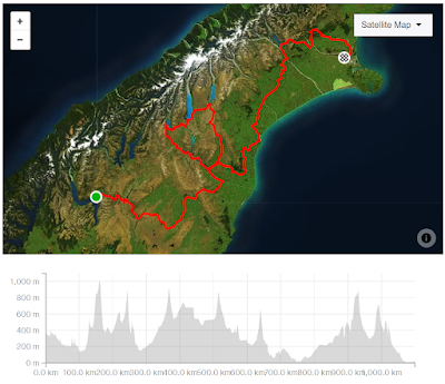
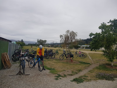
Day 1 - Queenstown to Alexandra
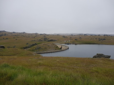
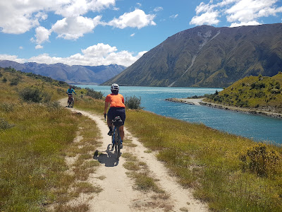
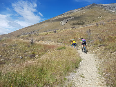
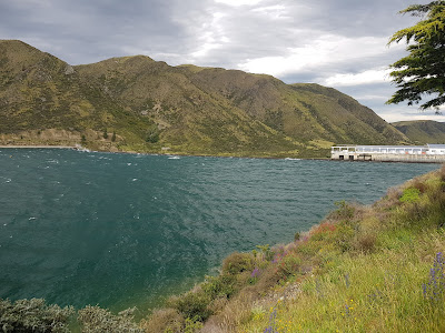
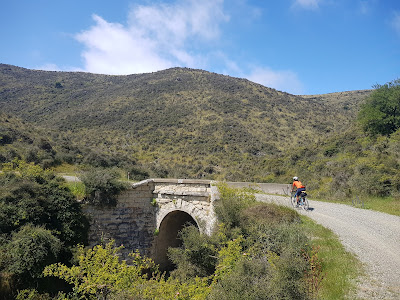
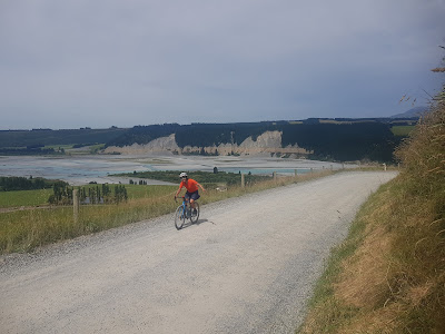
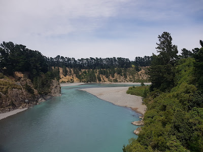
Our first day "on the road" included one of my most anticipated sections: the relatively new Lake Dunstan Cycle Trail. It was meant to be open when Brendan and I passed through in the opposite direction back in April, but delays had seen us riding the highway instead. It was plenty frustrating at the time, not least because we could see so much completed trail across the lake, and made worse by the plaudits the trail has received ever since it did finally open.
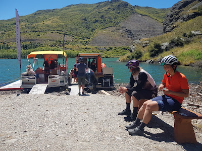
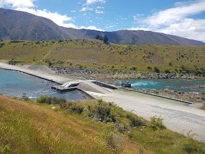
Before hitting the road, there were a few logistics to sort. After I'd dropped Khulie's gear to her new accommodation, I returned our rental car to the airport depot, retrieved my bike from the boot, and got ready to ride. Sarah rode there, and we rolled out together, eventually connecting with the Queenstown Trail at the Lake Hayes Estate and staying on it through to the Kawarau Gorge Suspension Bridge. The day showed every sign of becoming stinking hot, so we took a breather at the Bungy centre there, and got a bit more food and drink onboard.
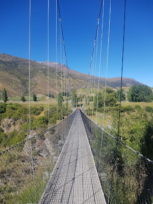 |
| Not the Kawarau Gorge Suspension Bridge, but rather a much newer one on the Arrow River Bridges Trail section |
The Boxing Day traffic along the highway through to Cromwell was not bad at all, and we were regularly the beneficiaries of great driving - plenty of patience and generous passing gaps. There are always uncomfortable moments, but it saddens me when I read of cyclists assuming the worst, and in many cases, talking themselves out of riding a section of road.
Unfortunately, the cafés in the Cromwell Heritage Precinct were all closed for the public holiday, so we made do with a bit of food and drink from a nearby convenience store, before doubling back to the Bannockburn bridge, and once across it, jumping onto the cycle trail for our rendezvous with Ashley and Steven at Cornish Point. Up until a couple of days earlier, we hadn't anticipated company, but were delighted to learn that this ride together fitted nicely with their rejigged Xmas/NY plans.
We hadn't kept them waiting too long, and we got rolling within a few minutes of arriving. This was Ash and Steve's second time on the trail, but by their accounts, couldn't have been more different from the first. By comparison, we had the trail to ourselves, and while we did meet oncoming groups from time to time, it was a far cry from the congestion they described.
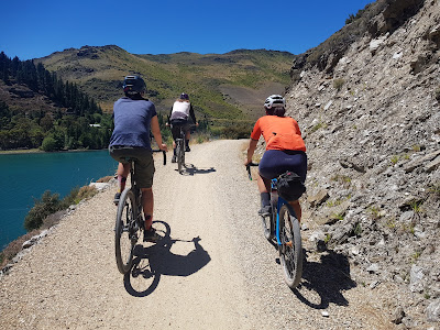
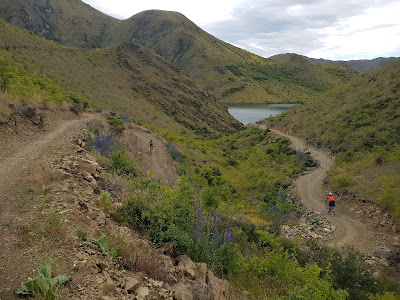
It wasn't long before we came to some of the most impressive features on the trail - a series of bridges bolted into cliff faces.
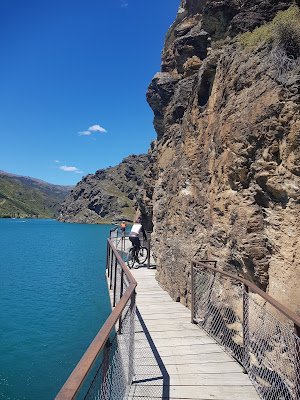 |
| The cantilevered bridges sitting above the lake surface were amazing |
Between spectacular bridges and a stonking tail wind, it was hard to believe the ride could get any better, and then we arrived at the mid-trail coffee cart! Its reputation had preceded it, but we had tempered our expectations due to the public holiday. The menu included a venison burger, which I didn't feel up to. Instead we ordered coffee, and switched to an iced variety upon hearing they'd had a power cut on one boat.
 |
| Not a bad spot for a trailside café! |
After ten minutes or so enjoying the sunshine and the novelty of mid-ride shopping, we jumped on our bikes and were straight into a climb. On the one hand I was lamenting the way my iced coffee was sitting in my gut, but on the other, I was greatly relieved not to be struggling to keep a burger down!
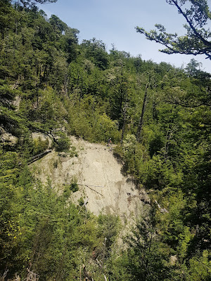
The climb afforded us great views back towards Cromwell, with some serious remediation evident above the trail (the Cairnmuir landslide, as it turns out...).
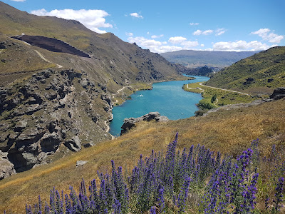
The trail lived up to the hype, and furthermore the width and non-technical nature of the surface afforded great opportunity to talk, admire the scenery, and enjoy the sight of three of my very favourite people in the world on board bicycles.
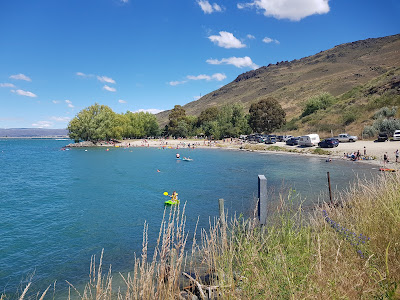
A beach shortly before the Clyde Dam contained considerably more people than we'd seen riding the trail, and it was a nice reminder that summer-time leisure comes in many forms.
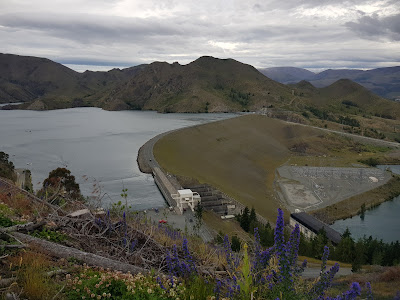
The dam itself was admired while on the move, and like the water, we were then treated to a nifty descent. A trail alongside the river took us to an old single lane bridge, and once it was our turn we crossed and alighted at the first café that we reached.
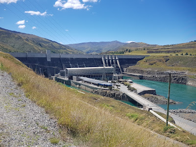 |
| Clyde Dam |
There, I tried to order a beer, and was disappointed (and slightly confused) when told they had none. Eventually I realised the source of my confusion - the establishment was called the "Recharge Bar". Instead we enjoyed juice and some cheese rolls (when in Rome, etc...) in the sun, during which time Steve replaced a punctured tube.
While we weren't necessarily done with conversation, Ash and Steve's return trip to their car was not going to be wind-assisted, and therefore not fast. Sarah and I too had a little further to ride. After a quick round of hugs and general appreciation for a lovely get-together, we made our way back over the river, Sarah and I looping under the bridge we'd just crossed and picking up the river trail again.
We still had the benefit of the wind, and also enjoyed a bit more shade as the path very often had tree cover. Our motel was back towards Clyde, so once over the river, we were able to survey the dinner and resupply options as we rode along Alexandra's main drag. Boxing Day meant we didn't have a lot of choice, but we didn't go hungry!
Stats: 111km ridden, hot and dry
Day 2 - Alexandra to Ranfurly
One of Ash's parting shots had been a breakfast recommendation, which we took her up on as a follow up to our go-to supermarket feed before leaving the motel (cereal, tinned fruit, yoghurt, milk). Our route to the Industry Lane Eatery was somewhat convoluted, but well worth the effort. We shared a couple of scones washed down with coffee.
We spent a few minutes on the highway out of town before turning off and before long picking up Crawford Hills Road. As always, a set of AA touring maps had been a primary planning tool, and while they're great for connecting dots, they don't give much insight into the terrain. Not to mention that I tend not to study them beyond the planning process, as I enjoy having my presumptions about what the day might bring shattered.
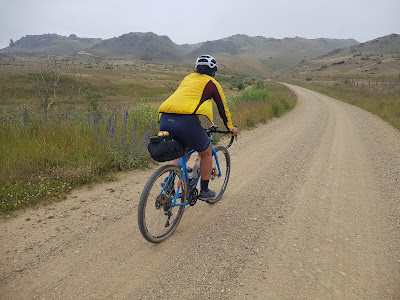
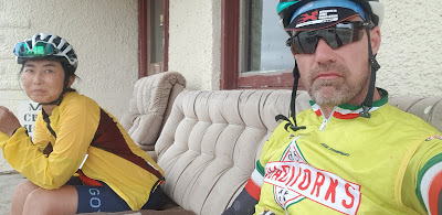
So it was that the ride over to Moa Creek wasn't at all what I expected, but thoroughly enjoyable in part because of it. We had a very mellow climb up the side of a ridge, which we duly crossed before descending into Ida Valley. After a few minutes on sealed road, we pulled up at the start of Old Dunstan Road. The building might have been a guesthouse, but in any case, the sofa outside made a great place to have morning tea.
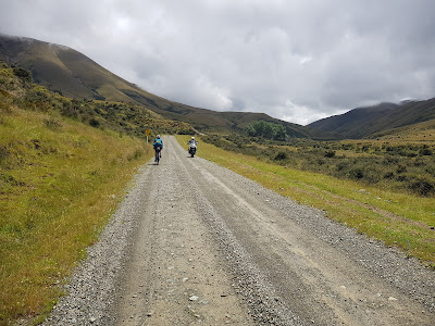
We began climbing pretty much immediately, and would be going uphill for the next 20km or so, until we were adjacent to Poolburn Reservoir. The weather had remained gloomy, but the riding effort was mostly cutting through the chill. Other vehicles were occasional, and we stopped briefly to chat to another cycle tourist, who was en route to Alex.
The lake itself was fascinating, and in particular the sprinkling of "holiday homes" around the place. I'm sure on a sunny day, the choice to stay up here - whether in a building, motorhome, or tent - would have made perfect sense, but it all seemed incongruous with the cold and overcast day.
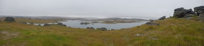 |
| Poolburn Dam panorama |
The road dropped down sharply to cross the outlet stream before climbing up to lake level again. Unlike the massive Clyde Dam from yesterday, we could've taken a much closer look at this one (even crossed it), but chose to keep moving.
 |
| The Poolburn Dam's actual dam |
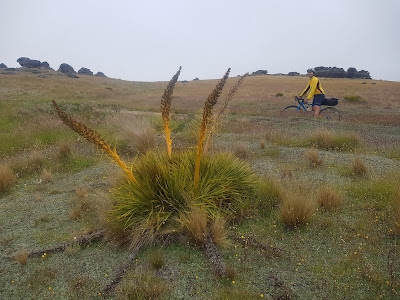
The bleak semi-alpine environment was pretty cool, and from time to time I would reflect on the good decision that Brendan and I had made to take the long way around - there was very little shelter, and this wouldn't be a great place to be during a cold wet southerly storm. Not least because it would've been nigh on impossible to enjoy the remarkable landscape - spectacular Spaniards (a member of the carrot family, if the internet is to be believed!!!) were in abundance, and are a great enhancement.
 |
| Enhancement... unless sat upon... |
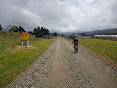
The road had been very road-like since our break down at Moa Creek, so we both got quite nervous when the way ahead more closely resembled a muddy farm track. My GPS hadn't charged overnight, but Sarah's confirmed we were still on Old Dunstan Road, so we continued and soon after were able to relax a bit more as the surface improved again - never quite to the earlier quality, but enough to convince us that all would be well.
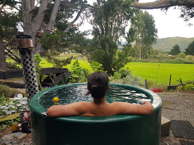
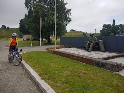
Aside from occasional stops to adjust clothing, and a toilet and snack stop at Patearoa, progress was good, and we rolled into Ranfurly around 4pm. We managed to sneak in a hot drink at a café just as they were closing up, before making our way to the B&B we'd booked. Or, thought we'd booked... A screw-up at their end necessitated relocation to Hawkdun Lodge, where we had a very comfortable stay indeed, but we appreciated our anticipated host sorting that out for us, and covering the extra cost.
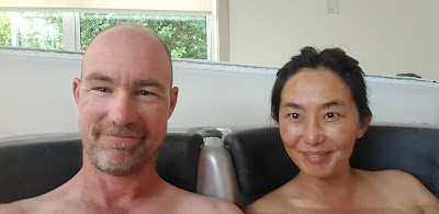
The evening was full of nice surprises really - the lodge had a free washing machine and dryer which was put to good use; the Ranfurly Hotel was open a day earlier than everyone expected and so we had a very nice roast dinner each instead of resorting to greasies, we enjoyed a private spa, and chuckled our way through Don't Look Up on Netflix once back in our room. Great success, all in all!
Stats: 100km ridden, not very summery.
Day 3 - Ranfurly to Kurow
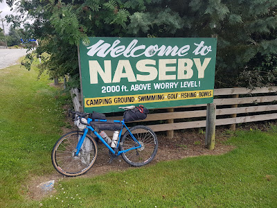
The morning's conditions were a carbon copy of those 24 hours earlier - cool and cloudy - and after cereal at the lodge and seconds at the café, we set off for Naseby. There I was able to reminisce a bit, having spent a few weekends some 25 years ago with one of the few high school-mates that I've kept in touch with, Mike Tannock. I messaged him later in the today to share where we were, only to discover he was in Wellington looking at an art exhibition from Otago! As he so aptly put it - "a weird reversal".
 |
| Amen to that |
Sarah I had an inordinately long wait for a coffee, which had us questioning the merits of stopping for one, but our perch on the footpath and the duration of our stay gave us a chance to observe the ebb and flow of the place. It was clearly a summer holiday hotspot, but also the sort of small town where permanent residents haven't joined the masses in the modern throw-away society (and ain't that great).
 |
| A rare "white on black" numberplate, and AP no less |
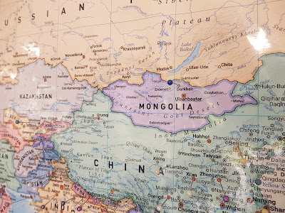
The 16km ride to the Dansey's Pass Hotel was probably shorter than the wait for the aforementioned coffee. Once there, we ordered a big bowl of fries and a beetroot and feta salad, not really because we were ready for lunch, but because it was the last chance to buy for a wee while. Upon checking our vaccine passes, the bar-tender (correctly) addressed Sarah as "Sara", which was enough for Sarah to (correctly) deduce that the woman was Russian. They had a jolly good natter in Russian, Sarah's second language - her home town in Mongolia, Darkhan, received extensive influx of money and people from the Soviet Union and she even went to a Russian secondary school.
 |
| Leaving Dansey's Pass Hotel, bound for the pass itself |
I really enjoyed the climb up to the pass - the gradient was very mellow, the gravel road had a good surface, and the scenery was fantastic.

Once over the highpoint, it became evident that we were riding this road in the better direction. We dropped steeply down into a valley before having another mellow climb, which in turn was followed by another fairly steep descent.
As we neared the Waitaki River at Duntroon, I saw occasional glimpses of the A2O (Alps to Ocean) cycle trail which was on the cards for a few days' time. It didn't look overly appealing in its current damp state, so we stayed on the road.
I hadn't checked the precise location of our accommodation until arriving into Kurow, so it was a bit embarrassing to discover it was the guesthouse we'd passed five minutes out of town. Since it was after 5pm, we decided to have dinner at one of the pubs before doubling back.
There we were warmly welcomed, and had a comfortable evening before eventually retiring to bed.
Stats: 106km ridden, 10 degrees, more's the pity.
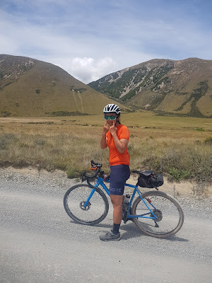
Day 4 - Kurow to Lake Tekapo
In the morning, we were treated to a banquet for breakfast, during which time our hosts also ascertained for us that we'd have no trouble crossing the various fords on the Hakataramea Pass Road - today's main event. The gravel road over the pass had been very eye-catching on the AA map, and it was one of the first definite sections at the planning stage. A subsequent realisation had been the option to connect to the A2O trail which would bring us back to Kurow, and after that we discovered the loop is written up as the Alps 2 Hakataramea Loop in the Kennett Bros' Bikepacking Aotearoa guidebook - might have been a good place to start!!
After a coffee in Kurow, we crossed the Waitaki River and then climbed up and over a knoll to drop into the Haka Valley, as the locals call it. The road was sealed for a good 40km or so, before turning to gravel at Cattle Creek.
 |
| Two cycle tourists |
One of the weirdest sights was a gigantic mushroon (bigger than my face) growing on the side of the road, but mostly eyes were off into the distance.
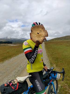 |
| See?! |
I was surprised when the road veered permanently away from the Hakataramea River, revealing that the "pass" I'd been assuming was ours, was not our target. As advertised, the various fords were all rideable, and we reached the summit without incident.

Conditions weren't conducive to lingering at the top, and after donning a windproof layer, we cracked into the 12km downhill - just the thing after climbing all morning. On the way down, for a few key seconds, I wasn't a very good cyclist...
I don't recall exactly where I'd been looking the precise moment I knew I was in trouble, but it hadn't been at the gravel "dune" sitting just off the riding line. I had a second or so to feel my front wheel sloshing around in it, waiting to be inevitably and unceremoniously tipped onto the ground. Sure enough, I went down fairly hard, and as I stood up, frantically running diagnostics while also signaling back to Sarah that there were a couple of hazards she needed to avoid (me and my bike, and the offending gravel pile). I knew for sure that the rain on my Gore Shakedry jacket (and bare leg) wouldn't have offered much if any protection, even before I looked to find both somewhat shredded.
That said, I'd seemed to have gotten off pretty lightly - not all my blood was on the inside, but at least both my sloppy shoulders were intact, and a few dents here and there (knee, hip, elbow, shoulder, pride) were the souvenirs I'd carry with me for the rest of the trip. Of course, my main fears then shifted to the state of my bike, but that too had fared well. Once I'd straightened my handlebars and brake lever, it was as if nothing had happened. As Brendan aptly noted upon hearing the story, at least the gravel had slowed me down somewhat before hurling me to the ground. Quite so, and thanks a fucking million.
Perhaps the rest of the ride would have been worse without the crash. The wind had really strengthened, and while it was never consistently in our faces, it wasn't wholly enjoyable. About 15km out from Lake Tekapo, we joined State Highway 8 at Dog Kennel Corner (without noticing a kennel). Between there and knocking off we were passed by more traffic than we'd seen in the last 350km or so since Cromwell! Fortunately for us, there wasn't much oncoming traffic, and so we were typically given plenty of space.
 |
| A few bucking the "no stopping for photos" request |
At Lake Tekapo we took the opportunity to not only get off the highway, but also to get off the road when a lakeside path became apparent.
Soon after we were checked into our accommodation and I was tending to my wounds. We had dinner at a Japanese restaurant, and enjoyed a very chilled out evening - the skies had cleared, but we didn't quite have the energy to stay up to see the stars fully come out to play - one of the few downsides of the latitude and resulting long days.
Stats: 111km ridden, and one of them very poorly indeed by yours truly.
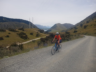
Day 5 - Lake Tekapo to Lake Ohau Lodge
We had our first full-bore café breakfast of the trip the next morning, and luckily were early enough that we dropped our coffee order before they ran out of beans (from Christchurch, apparently). For the duration of our meal, I grimaced every time they offered decaf alternative - as if folk were queuing up largely for the taste...
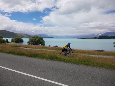
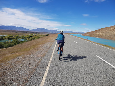
Once we were packed and rolling a coffee cart across the road seemed like the safest option for a second cup, before jumping onto the Alps 2 Ocean trail - on which we'd stay for at least the next two days. This is one of 22 "Great Rides" in the Ngā Haeranga cycle trail network, with the section we were about to ride being designated an "alternative start".
The "trail" took us through a small development of mini-McMansions before dropping down to the Tekapo Canal Road, which runs between the Tekapo A and B power stations. It was a fascinatingly complex area for the civil engineer in me that never was, with water moving this way and that - some spilling out of Lake Tekapo as overflow while other passing through turbines. And downstream some in the natural course of the Tekapo River bound for Lake Benmore and the Waitaki River, while the rest was in the man-made canal we'd be following en route to Lake Pukaki, taking the long way but donating a few more watts as it went.
 |
| What's left of the Tekapo River, spilling out of Scott's Pond |
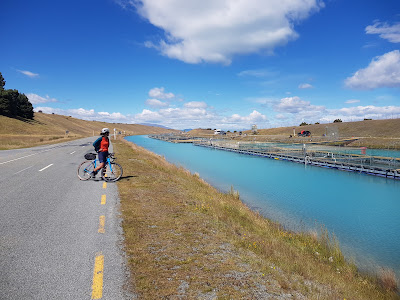
For a long while we were riding on sealed road, despite a very appealing gravel path on the other side of the canal. At least the road gave us great views over the river, which was consistently dropping away on our left. Before long, we'd crossed the Fork Stream tributary which actually passed through a short culvert beneath both the canal and the road! Nifty.
 |
| Top |
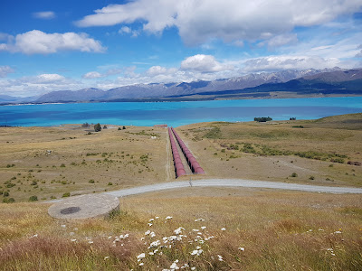
We took a short detour to check out the station, which I was glad of upon discovering that the interesting parts were all well and truly below the lake's surface. Good on them squeezing a bit more energy out of the water - it didn't cross my mind at the time, but now I wonder if it was built before the base was submerged by the lake. In any case, a top effort.
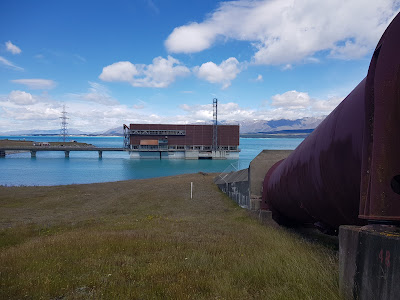 |
| Tekapo B Power Station |
After a short bit of road riding, we enjoyed some lake-side single track which was part of the A2O-proper - alongside the canal, we'd been on the "alternative start" up until this point. Freshly harvested salmon was on offer before we crossed the highway again, and was duly consumed!
 |
| Matchy matchy |
I really enjoyed the next section of trail which took us into Twizel - initially we descended through some conifers, and then had a long section out in the open through tussock. Despite being a relatively flat expanse and without notable natural features, the trail ducked and dived, and was rather fun. It is possible that the tedium of the canal had lowered my standards somewhat!
At Twizel, we stopped for a proper lunch at a café. Once underway, I got us a bit lost but eventually found the A2O trail again, and soon after that, realised we were heading back towards Tekapo. One U-turn later, we were on our way out of town, and soon to arrive at another godforsaken canal. It felt like we were alongside that one for yet another eternity, but it was actually only 10km of riding!
Initially we were travelling downstream, but after an intersection of two canals - the one we'd been following from Lake Pukaki, and the one we then took upstream towards Lake Ōhau. Once at the top of the canal, a gravel road took us to a weir, that if overflowing, would have necessitated a massive diversion to reach our final destination. No risk of that though, and we enjoyed blasting across the nifty structure.
Between the singletrack and our accommodation at Lake Ohau Lodge was some sealed road, but that passed quickly by. Just on the edge of the lodge's property I bumped into a colleague Amanda and her husband Mike. They were riding the trail also, but had started at Mount Cook Village and had stayed overnight in Twizel.
While the rendezvous with Amanda had been a surprise, not so to see Brendan and his partner Viv an hour later - a month or so ago we'd clicked we would be in the same neck of the woods (them doing a loop out of Timaru), and had organised to meet up here.
They'd had bike drama aplenty, and so we all had much to talk about over dinner. We shared a table with a family of four from Auckland, and so were not short of conversation.
 |
| Aoraki / Mount Cook catching the sunlight in centre shot |
Stats: 98km ridden. Bleurgh (not something I often think when reflecting on a day in the saddle).
Day 6 - Lake Ohau Lodge to Kurow
Dinner the previous night had been delicious, but given the market seemed mostly to be cycle tourists, was on the light side, energy-content-wise. Fortunately, I had no such complaints with respect to the cooked breakfast supplemented by buffet cereal.
Despite being among the few on self-powered bikes, we were the very last to leave, but not before being joined by Steven Fish, one of my team-mates from our 2018 Tour de France. He and his wife Hazel live in Waimate, and had been thinking about a few days away in their campervan when I got in touch from Ranfurly. He leapt at the chance to connect with us, and we'd been looking forward to his company since.
We had a final round of coffees with Brendan and Viv before wishing them a good ride to Lake Tekapo. Then, Sarah, Steve and I set off after the e-bikers...!
 |
| A rare pocket of native bush! |
It was a bit of a novelty for me to be able to follow Sarah and Steve up the first hill. He and I had been yacking when Sarah went to the front and put the hammer down, relatively speaking. He glued himself to her wheel, and I yoyoed off the back in between fumbling around with my camera and fits of giggles.
As foreshadowed by Brendan and Viv, who'd been through in the opposite direction the previous afternoon, it got quite rocky for a spell, and I slowed a bit to ensure I could pick a line that would be easiest on my poor overloaded steed. Once the rock garden was over, next came a crazy section of parallel ruts through pasture. I remain surprised that the bike rental companies don't see fit to clean these up - I very much doubt their punters realise how treacherous these can be, and would be surprised to learn that there aren't fairly regular accidents through here.
That all said, we soon found a peloton of e-bikers stopped for a snack. All seemed intact, though one fellow was cursing and swearing the inadequacy of his rental pump, and his bad luck at having to use it. For all our relative prowess, my wounds from the other day had scabbed up nicely, and Sarah was nursing a bruised hand after a clumsy low-speed post-stop manoeuvre hadn't gone to plan.
We bade them farewell, and then quickly knocked out a gravel road section which took us most of the way into Omarama, during which time Dr Fish spontaneously said "your wife's a fucking beast". Normally that wouldn't go down so well, but when spoken to a cyclist, during a ride with said wife, it elicits a great sense of pride. "Yep, she's a fucking beast alright" I replied, with a great big smile on my face, that also betrayed my appreciation that he'd seen fit to notice and mention it. Even when not at peak fitness, Sarah's power and prowess on a bike is indeed impressive.
It was lunch time, and we settled on a place down a side road, and ordered food (with a side dish of nurofen for Sarah). While we were queuing, I noticed a map into which patrons were clearly welcome to contribute pins to. Not for the first time, Sarah's became the first pin emanating from Mongolia!
 |
| MINT! |
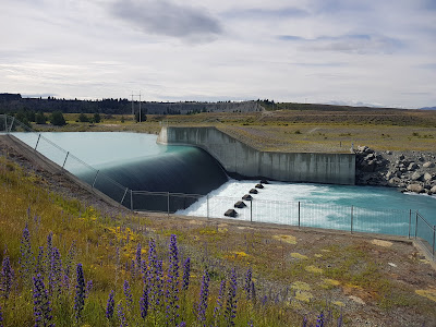
Based on what, I'm not sure, but it did surprise me that we didn't overlook Benmore Dam sooner, but it eventually did come into sight after a neat few minutes which reminded me a lot of that one time I rode in Colorado! Again, because I hadn't done my homework, I was surprised to see Lake Benmore sits behind a (no-doubt reinforced) pile of dirt. Well I'll be damned.
 |
| Benmore Dam |
None of us felt compelled to take a side trip into Otematata, whose complete set of syllables I struggled then and now to retain, and spent some time over the duration of the ride trying to piece together. On the other hand, the wind was in our sails, and I had no such troubles dragging us all along Lake Aviemore. Even without chasing a local too hard, we knocked it out with an average speed in the low 30s.
When I wasn't focussing on my pedals, I was trying to get my head around the campers. I assumed most had left big sections on the flat, only to drive to a lakeside and cram themselves like sardines into a gravel layby. The "sites" seemed only to have the proximity to the lake going for them, unless you like neighbours a few feet away on all sides. I don't recall seeing much of this in the North Island, but maybe I've never looked in the right places!
We crossed over the Aviemore Dam, before the "trail" became an actual trail again. I thought we might be done with the hydro scheme, but soon it became apparent that there was yet another power station downstream to come. Before long we reached it, only to find Hazel, Steve's wife there. She'd been "dot-watching", namely following Steve's location online - he was riding with a Spot tracker dangling off the back of his saddle bag, which constantly updated his whereabouts online. Hazel told us we'd had a long lunch break, which was true!!!
 |
| Waves running out of road at the bottom end of Aviemore. Luckily we were able to make better use of the tail wind |
We met Hazel again soon in Kurow, but not before enjoying some good wind and gravity assisted riding - the perfect combo. Once there, we had a celebratory drink and quick de-brief, and made a tentative plan to see Steve again the next day on the outskirts of Waimate.
After thanking and farewelling the Fishes, we headed for the other pub in Kurow, and had a jolly good feed. It was much quieter, but altogether a nicer environment to eat in ones lycra! Dinner finished, we had a familiar ride down the road to our B&B, where we got treated to some of the return-guest perks, namely a private spa and access to a table tennis table. It was a lovely way to cap off a great day's riding.
Stats: 111km ridden
Day 7 - Kurow to Timaru
The previous afternoon, Steve had made several suggestions about how to approach Waimate. The one that stuck was to ride over Meyer's Pass, which necessitated heading back up the Hakataramea Valley. Close inspection of the AA map threw up a surprising alternative to the sealed road we'd taken a few days earlier - a gravel road on the other side of the river.
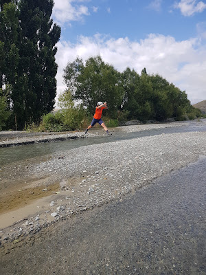
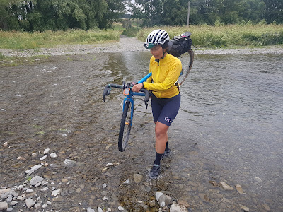
After another great breakfast courtesy of our hosts at Western House B&B, we rolled across the road onto the A2O. Even though it involved the immediate prospect of wet feet, riding the short section on the highway for the fifth time was uninspiring.
I carried the two bikes through the stream, but encouraged Sarah to try to keep her feet dry. She made a great stab at the first metre or two, but stalled in mid air, and ended up just as wet as I was!
 |
| What a great start! |
My GPS had inexplicably stopped a couple of kilometres from Kurow the previous afternoon, so I asked Sarah to sort a coffee order while I hooned back up the road to find my missing data. It took a little longer than anticipated, so after letting Dr Fish know we hadn't quite left as advertised, I duly sculled my coffee and got underway.
McHenry's Road proved to be a fantastic alternative, and a great way to cut out 13km of the sealed valley road, not to mention a short climb! I made a mental note to suggest to Jonathan Kennett that the next version of the Alps 2 Hakataramea Loop be amended to incorporate this (since done, and received with appreciation).
En route to Meyers Pass Road we passed through Foveran Deer Park, which piqued our curiosity with its boundary gates, but gave little clue as to what the fuss was about. Soon after Wrights Crossing we turned away from the Haka River and started climbing more earnestly.
Boy did we feel slow, thanks to the triple whammy of a sluggish surface, sterner gradient and a headwind. On reflection, I realised that we'd also ridden over 700km in the preceding week, so we weren't exactly coming at it with fresh legs!
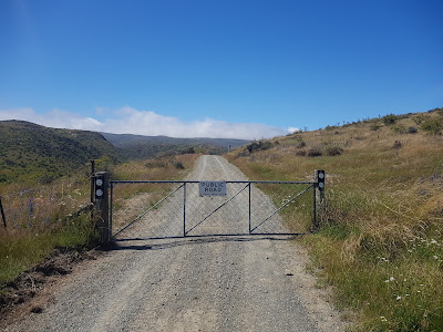 |
| "Public Road" |
Despite the required effort, the road was most enjoyable, and it was easy to feel a little more intrepid and even further off the beaten track than usual. I kept imagining Steven flying up the other side, and wondered if we'd eventually see him coming down towards us. In the meantime, there were other things to see, including a lovely old stone bridge.
Steve wasn't waiting for us at the top, and we ended up descending for quite a while before he came into view. As it turned out, we were not the only ones who'd made a slow start!
When we reached Waimate itself, Steve took us past his general practice (he's a local doctor), and then to the velodrome for a hot lap. We then accelerated towards his home for a cuppa, until Sarah announced that she couldn't shift into her big ring...
Gear shifting had always been an Achilles' heel on our Opens, and during the year we took the plunge to convert both to electronic shifting. Since doing so, the bikes hadn't skipped a beat (or put another way, had skipped a specific beat each and every time we'd asked them to). As advertised, a single charge had lasted months, and to date, we'd not had any low-battery indication. Each bike had spent a full night on charge just before we left Wellington, and I assumed that would have been enough for a couple of laps of the south island, let alone a single passage.
You'd think I'd have learnt from an earlier episode, but despite the modern charger being a much smaller unit than back when we first got Di2 for the tandem, I hadn't carried the charger with me. No matter, Steve was on the case!
Within minutes we were knocking on the door of one of his racing mates. He didn't have what we needed, but between the two of them, thought we should try Brad next. He lived round the corner, and not only was home, but didn't hesitate taking Sarah's bike inside and immediately firing it on the charger. The jug went straight on too, and we were treated to some amazing hospitality. (And yes, his racing bike lives inside the house, nice and close to the charger!)
Our destination for the day was Timaru, and after an hour or so of yakking, the battery had surely topped up enough to get us there. Brad insisted we take the charger north with us, lest we have further problems. Despite having had only a few minutes to freak out about the situation before it was being solved by those around us, it was so nice to have been helped in this way. I vowed to never leave home without the charger again, and with Brad's address copied onto my phone, we said our farewells with an overwhelming sense of gratitude.
That was the good news, the not so good was that we were still a fair distance from Timaru, and by this stage it was 3:30 in the afternoon! Making a beeline for SH1 would have been by far the quickest and shortest route (45km or so), but the route I'd planned using backroads would only add 15km, and would hopefully be sufficiently more pleasant to justify the extra distance. For a time that was probably true, but we couldn't quite sustain that frame of mind through to Timaru! (Well, at least not both of us!)
 |
| Recharging at St Mary's Church, Otaio |
The route was mostly unsealed, and at times rather convoluted. I was definitely surprised at the number of fords we had to cross, a few requiring us to walk through the water.
 |
| Sarah fording the Otaio River on Church Hill "Road" |
Eeeeeeventually, we arrived on the outskirts of Timaru. Sarah didn't notice "Rocky Hundreds Rd" which has to be one of the cooler street names I've seen, but the necessary pick-me-up for her was arriving at our overnight accommodation.
It was well equipped, and while a load of laundry was on (and the first bike on charge), I popped quickly to the nearby Countdown, managing to score breakfast supplies before it closed. That done, we had a late dinner at an Indian restaurant, and as we walked past the main police station which was just around the corner from our motel, knew that we'd get a good night's sleep. A hard ride and a good dose of stress will do that to you, even if the streets aren't uncharacteristically quiet!
Stats: 142km ridden, the longest day of our tour, and one bullet dodged.
Day 8 - Timaru to Methven
As it turned out, our troubles were not completely behind us, though they weren't of the battery charge variety.
Timaru was a ghost town when we rolled out, presumably the combination of it being both a Sunday morning, and the 2nd of January public holiday. Consequently a Wild Bean Café at the northern end of town seemed to be our first and best option for a coffee.
We'd arranged to meet up with Brendan for a ride through to Methven after he'd dropped Viv at the airport for her flight back to Wellington. Picking a decent route seemed like a bit of a lottery, but bridges over the various rivers we'd cross were few and far between, so we had some fixed points to plan around at least. We were aiming to meet him in Pleasant Point, and decided to go via the main road. As it turned out, there was a great cycle path along its length, which showed a weakness of planning off the AA maps (which tend to invite main road avoidance).
Brendan rang and I told him we'd just passed the Timaru Airport turnoff, revealing he was only a couple of minutes up the road. We were together soon after and cruised into Pleasant Point together. After admiring the local steam train, we settled on a hotel café for a coffee, and I spent the break experiencing serious food envy while watching Brendan enjoy a massive slice of cheesecake with his coffee!

After debating various options, we finally settled on a route, but for the life of me, I couldn't get it uploaded to my Garmin. Fortunately, Brendan was having no such problems, and so we were able to rely on his gadget.
We had a good ride through to Geraldine, where we stopped for some cold drinks and food. By this stage, Brendan had committed to a massive day, wanting to carry on through to Springfield where his boy Fletcher would be spending the night with his mum's family. Balancing the competing merits of company and speed, we stuck together for a while longer.
After crossing the Rangitata River, we dove off the main drag onto a quieter road. The complex network was a bit of a hoot, not least when we found ourselves at a six-way intersection.
| Intersection pano-madness |
Trouble came by way of Sarah reporting pain in one of her Achilles tendons. I had nurofen handy and these were used to take the edge off, and soon after we sent Brendan on his way so we could button off a bit. The prospect of seeing his boy would keep Brendan adequately fueled for what would end up being a 200km-plus day.
With a little less pressure to keep moving, we made one attempt to access a river for a quick swim. That failed, but on our second attempt we made it down to the shore. Using the road bridge as cover, we did a bit of skinny dipping and when we did start riding again, both of us felt a bit better for the time in some cool water.
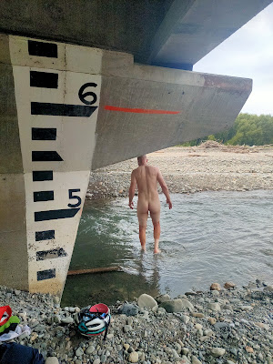 |
| Time for a cheeky swim! |
The route into Methven had looked so benign on the map, but unfortunately the gravel surface was amongst the worst we'd encountered. Fortunately I gave up on reaching the track along water race path, but even that wasn't without its costs as Sarah lost her front wheel pulling a very low speed u-turn, to add injury to insult. She was OK, and when we crossed the path a while later it was a relief to see we'd avoided an unpleasant bit of riding.
At Methven finally, we bumped into Brendan who was just setting off after an early dinner. Once at our accommodation, we discovered visible bruising on Sarah's sore tendon - an issue which we would have to confront the next morning, but which didn't prevent us from having a nice meal and otherwise relaxing evening. It helped that Sarah was able to spend much of the break with her feet up (literally), and there was even an icepack in our room's freezer box which was put to good use!
Stats: 125km ridden
Day 9 - Methven to Springfield
Overnight I took a careful look at Sarah's cleats, and adjusted the problematic side to bring her heel slightly closer into the bike. I also dropped her saddle 5mm in the hope that this would help. Beyond those things and the previous evening's R.I.C.E. treatment, it was a matter of taking it easy and hoping for the best.
Once we crossed the Rakaia River, we had a couple of route options for a relatively short day through to Springfield. Sticking with our booking and taking main roads would be about 70km, while a back route via Lake Coleridge would only add another 10km or so. We decided to give that a whirl.
Before leaving town, I bumped into a colleague (I thought I'd seen him the evening before, but we were both wearing masks and I hadn't been able to catch his Scottish accent then), and after a short conversation while consuming coffee, we got underway. Sarah and I parted ways briefly as I wanted to get off a (shorter) race route I'd ridden a few years ago, but we crossed the river together.
 |
| Other riders were few and far between |
After admiring the old bridge, we took a chance on Zig Zag Road together. It started very gently indeed, but I fretted about Sarah's injury when the gradient kicked up, and despite the great views we got back over the river, wondered if I should have forced her to take the long way around.
Aside from worrying about Sarah's tendon, the ride was also eliciting terrible memories of a Calder Stewart race I'd done on these roads. I'd been involved in a terrible crash - I wasn't hurt myself, but as I was passing a rider he'd looked over his other shoulder and swung into me, falling, and bringing a large number of others down, including my team-mate Lee who'd ended up being helicoptered to hospital with some serious injuries. Lee recovered, and people who'd seen the accident play out had assured me I'd done nothing wrong. But, I've carried a sense of guilt ever since which has contributed to my complete withdrawal from the road racing scene. I was hoping that the day's ride would bring me closer to closure.
The scenery was cathartic, and I would have sworn black and blue that I'd never been here before. Even with the context of the accident, I was surprised to have no recollection whatsoever of the valley. Just goes to show, you don't see much of the countryside when racing. What a waste!
The road was lovely, and while very occasional encounters with other users brought with it clouds of dust, that didn't distract too much from the stunning surroundings. I was also making good use of a backpack which I carry in case one of us needs to haul the other's luggage.
 |
| Both the mountain and Sarah pretending to cry |
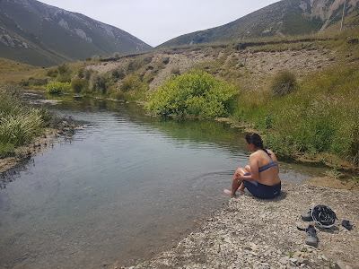
Just short of Lake Lyndon, I spotted a lovely looking pool beneath the road, into which Sarah jumped. The water was beautiful and clear, but I was put off ever so slightly by some didymo-like snot around the edges, and not at all slightly by the temperature! I'm such a pussy.
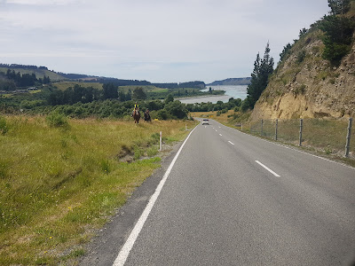
We found the lake a hive of activity, as was the main road from Christchurch to Arthur's Pass and the West Coast just beyond it, which we could see at the far end.
Once we got to the highway, we turned right, and quickly dealt to the short climb up to Porter's Pass, and then a near 20km-descent down to Springfield. Before checking into our overnight digs we enjoyed some food and drink, and made the somewhat weird call to order pizzas for our dinner despite needing to pick them up at 4:30 when the store closed (clearly targeting through traffic rather than locals)!
A couple of nights earlier, I'd reached out to Stu and Aaron - more One Day Ahead vets - living in Christchurch and Rangiora respectively. While Stu was out of town until the following evening, Aaron was keen to ride with me the next day. Unfortunately, although Sarah had made it through the day's ride, her other tendon was also now visibly bruised. Aaron's wife Sonya was very happy to kill two birds with one stone - dropping Aaron off, and taking Sarah home with her!
Nonetheless, her tendons spent much of the evening on top of frozen peas, though we were thinking more about what might lie beyond Rangiora than before it.
Stats: 81km, gently ridden
Day 10 - Springfield to Rangiora
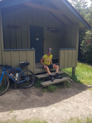
I'd been through the Wharfedale Track only once before, on day 4 of the inaugural Kiwi Brevet. Then it was part of an epic 260km day between Arthur's Pass and Culverden, but I still recall Tim Mulliner mentioning he'd done it as a loop from Oxford, and I'd stored that away for the 10 intervening years. Today my curiosity would be sated.
We hadn't bothered trying to scrape together breakfast ingredients at the service station, but instead were over at the café when it opened. I ordered a plate of pancakes in Simon's honour - not only as the architect of the brevet, but also because he'd recommended the café. I was enjoying the pancakes when the irony of taking a non-coffee-drinker's advice hit me.
Sonya and Aaron arrived before we'd finished our breaky, giving us a great excuse for a second round of coffees. That done, we went to get our gear and Aaron's bike was replaced by Sarah's in the back of their wagon.
I also took the opportunity to reconfigure my own bike slightly - the overnight gear in my saddlebag was replaced by bad weather contingencies, and my handlebar roll was removed entirely.
As it had been with Ashley and Steven, Dr Fish and Brendan, it was great to spend a bit of time catching up with Aaron, and the quiet gravel roads between Springfield and the Waimakariri Bridge were perfect as we could ride alongside one another.
The river was as spectacular as ever, and crossing it with Aaron was even better given he and it had a lot of history. He'd been paddling it regularly in preparation for the 2-day Coast to Coast, an event which has subsequently been overrun by the pandemic settings.

Aaron had mentioned a few times that he wasn't overly confident on the mountain-bike. In France, he'd really transformed on into a roadie - amazing what 3500km will do - but before and since, cycling had generally been part of a multisport event, or a simple leisure activity. I was glad he was on a fully, and hoped that my willingness to ride on a fat-tyred road bike was helping his nerves somewhat.
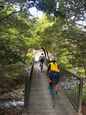
I rode behind throughout and nattered away, hoping to relax him. For my part, it was so nice to FINALLY be riding in some native bush. It had been such a frequent occurrence in last summer's tour, and while Otago's wide open spaces had been impressive initially, hundreds of kilometres without tree cover had done my head in.
Initially, the track was in great condition and 100% rideable, but as we got closer to the hut at the far end, we seemed to be getting on and off the bikes constantly. This has a fatiguing effect, but I've enough experience to not also fret about how it also tends to blow out the duration of the ride. One thing was clear though, it would have absolutely demolished Sarah's already compromised tendons, and it was a relief to know she was with Sonya.
My memory beyond the hut was clearly very hazy, and I was surprised not only by how long it took us to get from the end of the singletrack to the Lees Valley Road intersection, but also by how arduous the route was - involving a number of river crossings and a bit of scrambling!
It all took its toll on Aaron, but luckily I had just the remedy. I'd bought a Garmin inReach mini almost a year earlier, but had not registered it until just before leaving Queenstown. I vaguely knew how to use it, and was hoping I wasn't about to let Aaron down. I fired it up and it paired with my phone, and via the Earthmate app I composed a waambulance message to Sonya. I hit send, and crossed my fingers.
Within a minute, I got a reply, indicating she'd meet us at the end of Lees Valley Rd. Great success, and particularly because there was no standard cell phone reception - the inReach works via satellite, and those are obviously not reliant on cell towers!
As it turned out, there were a couple of stern climbs between us and the rendezvous point. I was really enjoying the views, but Aaron was done. I was trying to cheer him up, while he was feeling stink about slowing me down.
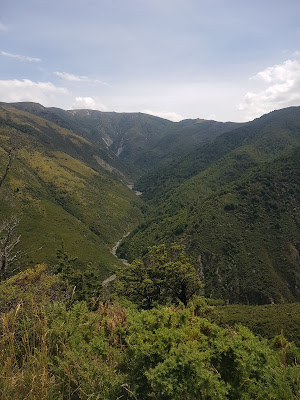 |
| Highly recommended views! |
After a stonking descent to a concrete bridge over the river, I suggested we send another message to Sonya, and that he hunker down in the shade. That agreed, I pressed on alone up the next fairly solid climb, enjoying being solo for the first time in weeks, and having bugger all gear on the bike.
When I saw Sonya, I stopped to let her know where to find Aaron, and was told in return that she was running low on gas. That made me a little nervous, and I decided to do the delay my final descent until they came past. It was an incredible place to sit, with views across to Banks Peninsula. I had a nervous wait for them, but when they did appear, they were sure they'd make it into Oxford for petrol! I was glad not to be heading off to find a jerry can!
I had about 35km to ride back to their place in Rangiora, and it was not without its frustrations. For one I seemed to have chosen a route that went over the only hill in the whole area, necessitating some fun but ultimately successful navigating on the fly. More annoying was that my rear tyre kept losing air. I knew the issue was that the tubeless sealant must have run dry, but decided I'd rather top the pressure up every few kilometres than replace the tube. The latter would probably have been quicker, but I didn't want to get my hands all grimy, so put up with half a dozen stops.
That evening, alongside a fantastic dinner out, we brain-stormed various options for getting home. Sonya and Aaron were keen to help if they could, and we also contemplated a rental car (insanely expensive to leave at Picton), train (not running due to low demand during the pandemic), and riding (seemed foolish, given Sarah's condition).
As the decision became clearer, I also realised that I'd had my happy ending, riding wise. The route with Sarah through to Lake Lyndon had been one of the nicest days of the trip, and the Wharfedale and its stunning beech forest had also been wonderful. Ahead lay three days of predominantly paved roads, including a full day on SH1. If Sarah rode with me, I'd be constantly worried about her health, and if she weren't riding with me, I'd be constantly lamenting her absence.
From all the bad options emerged a good one - we'd overcome all our problems by flying home from Christchurch. We made a brunch date with Stu for the morning, and slept soundly in the knowledge that the only potential wrinkle was sourcing a couple of boxes at the airport.
Stats: 116km ridden, one new plan made.
Day 11 - Rangiora to Christchurch airport
The next morning, I popped a tube in my rear wheel before Stu picked us up. It was wonderful to catch up with him, and we undertook to be a bit more deliberate about catching up in '22.
Back at Sonya and Aaron's, we packed up, before saying our farewells to them and their magnificent (not to mention huge) Newfoundland dog, Hudson.
A few deserted gravel roads took us into the outskirts of Kaiapoi. It isn't often that I forgo the opportunity for a coffee stop, but on the slim chance we'd have to go in search of boxes, we kept moving.
From Kaiapoi, we were treated to a dedicated bridge across the Waimakariri, and then a separated cycle path almost the whole way to the airport.

There of course we found boxes were in abundance, and we packed up the bikes outside in the shade of the terminal. That done, we retired to the Air New Zealand lounge, until our flight was ready.
Stats: 30km ridden, one plane to catch.
* * *
Far from being an anti-climactic way to finish, in hindsight it was perfect. As I already mentioned, the last couple of days of riding were among my very favourites for the trip, and it was nice to end on them. In addition, getting home a few days earlier was a godsend and enabled us to catch up on various essential tasks before heading back to work.
What caused Sarah's battery to discharge and her tendons to inflame are still a mystery, or to be more precise, two mysteries. I'd also had shoe problems throughout, but especially on the hot days, so chances are we're both looking for new touring shoes (both have the perfect amount of flex in the sole relative to our stiffer earlier models, but mine a tad narrow perhaps, giving pain on the outside knuckles...). While the bikes are almost clean enough to eat off, I still haven't made sure the seat heights are correct.
Sarah had once again been a great companion - dependable, a great source of conversation, and physical form set to enhance any landscape. That was all completely expected.
As well, it had been lovely to have the company of others on half of our riding days - somewhat of a novelty these days, and totally unanticipated, which made it even better. Brendan and I don't see nearly as much of each other as we did when we were both racing, and we've missed regular dinner with Ash and Steve since they left Wellington a couple of years ago. Dr Fish, Aaron and Stu became like family while we rode in France, but living in different islands and having otherwise busy lives prevents more frequent reunions. It was so good to see all of them.
Since leaving Queenstown, Sarah and I covered almost exactly 1000km over 10 days, while I'd added another hundy with Aaron. I'd have preferred to do a better job coming off of Haka Pass (and not coming off my bike), and of course, it was unfortunate that Sarah's tendons flared up. Route-wise, I'm really happy with our choices, and both bikes and Revelate bags were perfect - the charging issue is on me, one way or the other.
It is hard to know what 2022 is going to bring. But I hope the key ingredients of this tour - cycling and dear friends - make regular appearance.
Happy New Year, and thanks if you made it this far!!