Wednesday, November 18, 2020

The four corners of Chatham Island

As New Zealand's Level 4 lockdown rolled along, it became increasingly clear that overseas travel was going to be off the cards for a long while to come.  While Sarah and I had two trips booked (Northern Italy, and Japan), it was easy to keep things in perspective, given the hell much of the world was going through, and it was nice that the cancellations were out of our hands.  

Having travelled our guts out over the last couple of years, we were nonetheless motivated to travel domestically when we could.  One evening on a whim, I spent a bit of time on Air Chathams' website, and while it would be a few months before we'd pull the trigger on tickets, the seed had been well and truly sown.  

Mum and Dad had been booked to go to Italy with us, and having gauged their response to our booking news, another couple of tickets were immediately secured.  In all, we'd spend 5 nights on the island, and by virtue of these straddling Labour weekend, Sarah and I only had to take a couple of days off work.

By the time our dates rolled around, we had not one, but two Open U.P.s in the family.  I'd first used mine to explore Niue, before doing a 200km road gran fondo on it, and am so in love with it, that I've barely ridden another bike since.  Securing one for Sarah both enabled her to see what all my fuss was about, and would ensure we'd be completely compatible on the unbeaten path.  

On travel day, I dropped Sarah and the bike bags at the airport, then drove to Mum and Dad's before returning with them to the airport in a cab.  At check in, Sarah had been informed that the plane was full of freight, but we were promised our bikes would arrive at lunchtime the next day.  

Travel day is always exciting!

The flight path out of Wellington was awesome - we took off to the north, and then headed east over Wainuiomata, and South Wairarapa.  We were on the right-hand side of the plane, so were able to look down the various valleys towards the south coast.  The islands are about 800km east of the mainland, so for a long while it was just ocean out the window, until we started our descent, and the view out the window started getting interesting again.  

We flew just north of the narrowest point of Chatham Island - from Petre Bay in the west, to Hanson Bay in the east.  Out the window, we could see Lake Huro and the southern part of Te Whanga Lagoon, as well as North Road.  We did a 180-degree turn over the ocean before coming into land at Tuuta Airport (CHT for the Av-geeks).  


Looking south over (L-R): Te Whanga Lagoon, Lake Huro, Petre Bay. North Rd in the foreground


Fresh off an impressive result in the previous weekend's election, local MP Paul Eagle was on the plane - flying from one end of his Rongotai electorate to the other.  We had a short chat to him, during which he recommended a café (though without stressing that it was open only once a week!!).  

We were staying at one of many accommodation options run by Hotel Chatham, and had organised a shuttle from the airport to our two rooms in the "Lookout" complex.  It was kind of nice not to have our bikes, and by the time we'd got oriented and unpacked, it was time for the five minute stroll down to the restaurant.  

En route we passed the city council building, the police station, and the Waitangi Cafe - luckily not the one we were after, since it had a sign just inside the locked door, reading:  "CLOSED - Low on Kai - SORRY".

Fortunately, there was no such issue at the hotel restaurant, and we all enjoyed our first dinner of one of the island's mainstays, blue cod.  De-lish!

Once we got home, we had a bit of an online search for the café Paul Eagle had recommended, and eventually stumbled upon the River Onion's facebook page.  It was just as well we did - scrolling back over the recent activity in their feed, an important pattern was immediately evident - they only opened on Saturday mornings, and only stayed so until "11:30ish", i.e., until the food ran out. 


South-West

First order of business was a walk to the River Onion.  It took about 15 minutes, and after an enjoyable poke around their garden, we were second in the queue when they opened just before 9am.  The food and coffee were great, as we'd been promised.  


Given how the queue had grown behind us, it was very tough not to go berserk...


Feeling nicely sated, we scoped out the two grocery stores, and then headed to the hotel to enquire about collecting the bikes from the airport.  My companions saved me from a melt-down, upon being told that we might not get the bikes until Tuesday morning - it was Saturday, but there was an open day at the airfield, Sunday everything was closed, and Monday was a public holiday.  

Given we would be flying home on the Wednesday morning, I was not at all excited about the prospect of a riding holiday with at most a single ride.  In the end, it seemed that the best (and really, only) thing to do was hire a car, and go for a drive (in "Weka" - most of the rentals are named after birds).  

We started the drive by visiting the Air Chathams freight office in Te One, and spoke to a staff member.  She warmed to the idea of us getting our bikes once she realised they were checked baggage rather than freight, and told us to come back at 5pm, by which time the clean-up from the open day should have been done.  

Feeling a little bit more positive, we had a lovely drive around Lake Huro, which involved a fair bit of gate opening, and passing through a large paddock full of cows, sheep and emus (!!), past the island's power station, en route to the wharf in the tiny community of Owenga.  Our timing was great, and we were able to watch a fishing boat being hauled out of the ocean in very slick fashion.  Not more than a few minutes elapsed between a bloke jumping off the boat onto the jetty, and the tractor engine being switched off!  

It was a few more minutes drive out to the road end to see a statue of Tommy Solomon - the last full-blooded Moriori.  We sat and watched two very large seabirds behaving strangely, and Sarah narrowly avoided being gobbled up by a sunbathing seal.  After the bike-related stress, it was very nice to be able to relax in the sunshine with my nearest and dearest.


On a whim, we took a short detour back past the freight office.  It was only 2pm, but lo and behold, our bike bags were sitting forlornly under the verandah.  Even had the airline known the value of the bikes, I'm sure they still would have left them out front - Chatham Island doesn't strike me as the sort of place where bike theft is an issue,

The previous evening, Tom Paulin (a cycling buddy living in Singapore, who had lived just across the road from mum and dad as a boy) had got in touch with GPS coordinates of a beach on the lagoon, at which he'd found a fossilised shark-tooth. I suggested the others go check it out while I built up the bikes.  They returned about 10 minutes after I'd finished my work, with nothing but a telling-off for their troubles!  The island is entirely private land, and someone had given them an earful for straying 20-metres off the airport road to the lagoon's edge.  

Sarah and I rode the 5km back to our Lookout, while Mum and Dad drove the bike bags.  There, we cyclists suited (and helmeted) up, and struck out for the first of the island's "four corners", the one we were closest to, in the South-West.

The road turned to gravel almost immediately, and we climbed out of Waitangi past what looked like an old government radio station.  I suspected this is where Upper Hutt (and ex Commonwealth Games) cyclist, Tony Graham, worked for a year in the early 80s.  Initially, the scenery was a lot like we'd already seen - low lying farmland, with some massive patches of gorse!

Low lying farm land and a massive patch of gorse!!!  (Told you so)

Every 5 minutes or so, we'd pass a farm house, and were surprised to see a radome off in the distance.  


You're not on Hawkins Hill now, Dr Randal

Even more surprising, was that the landscape looked more and more like Mongolia (ignoring the ocean, of course) - in particular, the lush green pastures, absence of fences, and free-range cows and sheep.  It was very cool indeed, and not at all what we were expecting.  


There hadn't been much in the way of bush, but near the road end was a conservation area, and with it came some natives at long last.


Soon, we came to a locked gate.  We debated the merits of continuing, but a council sign just inside the gate, warning that the road was unmaintained, seemed to imply it was fair game.  Besides, there was a bicycle friendly track around the gate, which we took.  

While we had lights, we had also told the grandparents we'd be only a couple of hours.  We could see the road stretching off into the distance, and it didn't look like a dead end was going to force us back any time soon.  

Instead, nature stepped in, and in the most wonderful way possible.  I startled a couple of large birds which I instantly identified as parea - the Chatham Island pigeon - a cousin of my favourite bird, the kererū.  They didn't fly far and settled beside the road.  I stopped, and signalled for Sarah to do the same.  We walked as close as we dared, and realised there were not two but four of them, behaving very much like common pigeons, browsing on the ground (something I've never seen kererū do).  


We admired them for five minutes or so, and then decided this was an auspicious point to start retracing our steps - it seemed very unlikely we could have ridden past the magnificent birds without ruining their meal.  

Our just reward was yet another parea, again on the ground.  This one I approached slowly, snapping photos as I did so.  What a treat!


The ride back to Waitangi passed quickly, interrupted only by a short conversation with some locals.  We told them we thought it looked like Mongolia, and turned down their kind offer of a lift back to town!

Many of the trees betrayed the battering they get from the wind

Ma and Pa were either pretending to be relaxed about our lateness, or they actually were, and after a quick shower, we joined them down at the hotel for dinner.  Afterwards, we drove up the nearest hill, and went for a short walk to a lookout giving a view of the fairly new wharf.


The interpretation panel at the lookout had a quote on it that stuck with me - something along the lines of  "god made the Chatham Islands last - he used whatever he had leftover in his wheelbarrow."  The first day's explorations had indeed been surprisingly full of variety, and there was more yet to come.  


Stats:  38km ridden, 0% sealed


North-East

The next day, Mum and Dad were booked on a tour, while Sarah and I were striking out for what looked to be the most remote corner, in the north east of the island.  

The hotelier, Toni Croon, had been a bit nervous about us riding on North Road beyond the sealed section (which ended just beyond the Air Chathams office at Te One).  We figured if we could survive "the notorious Suhua Highway", we'd cope with whatever the Chathams served up, but it was probably not a bad thing that it was a Sunday -  there shouldn't be any trucks on the road, and there would be no airport traffic.  As it was, we only saw a couple of vehicles in the first hour of riding, and it never really picked up!
 

Heading north, on ... North Road

We had a pretty big day ahead of us, so we didn't add in the dead end road to the airport, and we similarly ignored the next day's turnoff towards Port Hutt.  We'd discovered that our presence got any nearby cattle in a tizz, and so were often spending minutes at a time with a herd stampeding just ahead of us.  Invariably, they'd go crashing over a fence at some point, causing us to cringe even more.  

North Road hugged the shore of Te Whanga Lagoon for a wee while, and we noted many black swans on it.  Just prior to turning off the main road, we had a short nosey at a schist mine, one of a few we passed during our visit.  


Wharekauri Road took us up over a ridge from which we got great views of some of the distinct hills in the area.  


Over the top of the ridge, the road went through a stand of pine trees, and when we emerged out the other end, we had great views down to the northern coast.  The colours of the ocean were stunning, and there was a lovely turquoise strip along the shallows.    


At the road end, we met some locals driving.  They told us that we'd been on private land for a fair while, but didn't seem overly fussed about it.  We warned them that Sarah had dropped a couple of muesli bars on the descent and asked them not to run them over!    As we set off back up the road, a van-load of tourists was heading through a farm (off to to see Splatter Rock), and we wondered if amongst them were the grandparents.  Giving the residents the benefit of the doubt, it must have been the van that had run over one of the two bars!

Back on the main road, we started to ride in a more easterly direction, with sand dunes on our left, and the lagoon on our right.  There were some lovely pockets of native bush, which made a change from the gorse, open pasture, or tussock.  


While we'd forgone a few extras up to this point, at the Ocean Mail Scenic Reserve we decided to do the full Lake Loop (overlooking that the MTB symbol in the DOC Brochure only applied to the very first part of the track).  There was a wee bit of walking involved, and it was frustrating at times to be making very slow progress, but after the best part of an hour, we were back on the gravel road.  

The Aster Walk, Ocean Mail Scenic Reserve

Soon after, we entered Kaingaroa Station, and turned right at the first intersection, down a road terminating at the JM Barker (Hāpūpū) National Historic Reserve.  There was a tour group just inside the reserve, but between them and us was a sign indicating we shouldn't enter without a guide.  Had we been a bit more prepared, we might have been able to see ancient Moriori dendroglyphs (tree carvings).  

A spot of R&R

Back on the bikes, we had a stiff headwind to tackle through to the intersection, before continuing past the turnoff to Kaingaroa village, and on to the gate of Muirson Station, through which we'd pass to reach Point Munning.  At the gate, it suggested that we should stop at the farm house, since we hadn't pre-arranged access.  No-one answered the door, so we rode on.

There were a couple of attractions on the station, the first of which were the remnants of a German missionary settlement.


After another few gates, we reached the Point Munning conservation covenant, and rode along a lawn-mower-wide path until its end.  We sat for 5 minutes and watched dozens of seals playing in the ocean (and a few sunbathing on rocks).  I spotted one penguin in the water too, but it vanished, never to be seen again!

Admiring the Point Munning seal colony

We tried again at the farm house on the way back, but still no answer.  We then tried a second home, and were told it was no problem to go visit the seal colony (phew).  Unfortunately, I didn't ask about the Sunderland Flying Boat remains, which unbeknownst to me were inside a massive shed not 50 metres away, but we did see the remains of a Fokker Friendship lying in the garden.


Sightseeing done, it was time to return to Waitangi, some 55km away.  On the way back, we ducked into the wee fishing village of Kaingaroa.  It had a jetty, a primary school (the other on the island being at Te One), and picture-postcard beaches.  


About 20km later, we reached the point that North Road turned south, and we'd have a stonking tailwind back to Waitangi.  Before we got there, we were hailed by two guys in a ute, who just happened to be the brothers we'd spoken to the evening before at the opposite end of the island!  They offered us a lift again, which we declined (again)!

Despite feeling a touch weary, I couldn't resist checking out the short "MTB" loop in the Nikau Bush Conservation Area.  Sarah's self control was much better than mine, so she continued south alone.  The loop had its moments, and better to regret something you did, than something you didn't...

Deep in the Nikau Bush

My legs seemed up for a bit of a downwind smash-fest once back on the road, until soon after, they weren't.  The MTB trail was short, but had been pretty slow, and it seemed very unlikely that I'd catch up to Sarah, even though I had the best part of 25km to get to Waitangi.  

Once there, I headed straight to our unit.  It was no surprise to find it deserted, since I still had the bloody key in my pocket.  I had a quick shower and headed down to the hotel to join the family, and inhale a much needed dinner - Sunday roast, of course.  

We'd seen the bus-load of tourists at JM Barker Reserve, and again on our way out of Point Munning.  They'd passed me after my Nikau Bush excursion, and Sarah some time later up the road.  I got more than one gentle ribbing in the buffet queue that I hadn't been able to keep up with my wife...!  Apparently the bus had been divided as to why I was so far behind.  

Mum and Dad had enjoyed their tour, and had made some friends (as well as seeing some sights - Splatter Rock included, though later in the day than the group we'd seen heading there).  

Stats:  156km ridden, approx 10% sealed


North-West

My organisational skills peaked on Day 3.  Mum and Dad were happy to drive our route, with a view to connecting at a couple of the main sights and also hauling some food and drink around.  I suggested that Sarah skip the first 45 minutes of the ride, keeping out of the wind rather than joining me as I grovelled along the same stretch we'd started on the previous day.

This time, I did go down to the airport, where there were three planes on the apron - a couple of older turboprops, and a brand-new (to the airline) ATR 72 (which we'd flown in on).  

The older stalwarts of the fleet

"Weka" had passed me early in the ride, bound for a beach along North Road, where its passengers hoped to find some fossilised shark teeth.  My progress since I'd seen them had felt slow, yet I wasn't sure who'd be waiting for whom.  As it turned out, they'd had time to find a couple of teeth, and get back to our designated meeting point a few minutes before I arrived.  

Once Sarah's bike was out of the car and I'd inhaled a couple of cookies, it was time to continue battling into the wind.  Sarah was well rested, but my legs were warm, and it took a while to get our pacing sorted.   


The road was constantly undulating, and was much more like the first day's ride than the second.  On the other hand, the vegetation was very different, reminding me of the Desert Road in the Central Plateau of the North Island!

Our first tourist stop was a cracker.  Toni had given us a gate key, and a farm track took us down to the coast, where Sarah finally discovered what "basalt columns" are.  The mini giant's causeway consisted of a number of really impressive outcrops, over a 300m stretch of coastline.  The "wheelbarrow" parable was making more and more sense.  


After about 15 minutes admiring this incredible feature, we headed off the private property and back into the headwind.  It was fascinating feeling like we were riding through an alpine environment, but in a haze due presumably, to sea spray kicked up from heavy seas pounding the northern coastline.  


We hadn't seen the parents since the basalt columns, but they were waiting for us at a farm gate, through which was the Maunganui Stone Cottage, built in the 1860s by German missionaries.  We followed the vehicle tracks to another gate, and from there, walked, accompanied by a loud but otherwise friendly dog.  


Toni had rung ahead and let the cottage's inhabitant, Helen Bint, know we were coming.  She's a bit of  a celebrity, and told us all about her fascinating life off-grid (the generator was "too noisy").  Despite not being overly keen on dogs, Helen's dog seemed keen on me, and opened up a bit of freshly healed skin on my knee with a gnarly claw, much to my disgust.  That said, it was a small price to pay for an interesting spell out of the wind!  


Another party arrived, and we soon excused ourselves.  


Back at the road, we all continued to the Waitangi West roadend, the parents continuing a little further than I would have, by passing through someone's closed gate.  On reflection, much of their previous day's tour would have been through closed gates, and it wasn't always easy to know how to interpret them.   

It was a lot of fun seeing the sights this way, and we regrouped again at Port Hutt.  We didn't go right to the end of the road, but far enough to see the wreck of the Thomas Currell in the harbour.   


From Port Hutt, the road was just as up and down as it had been in the outbound direction, but this time the wind was much more favourable and it passed quickly.  Sarah and I didn't talk much, but I was constantly pinging off photos of her as she approached and then disappeared off into the distance!


Just short of the intersection with North Road, Mum and Dad had sorted out a tour of Admiral Garden (owned by our hotelier's parents).  There, we heard a whole lot of interesting things about island life, including that the high-school aged kids all go off to college "in New Zealand".  

Chatham Island Forget-me-nots.  In situ.

Over the span of about 20 years, the Croons had transformed a paddock into a very lovely home and garden, and it was a treat to be shown around.  

From there, Sarah and I bade Weka farewell - we planned to take a long cut around Lake Huro - the only loop road on the whole island.  While the emus had been in full view a couple of days earlier when we'd driven through, unfortunately we only saw one, and it wasn't particularly close.  

Wind battered akeake (Chatham Island tree daisy)

After 10km or so, and a bunch of farm gates, we joined the main road between Owenga and Waitangi, just up the road from the power station. 

Island's power station


A downside of the detour was that we faced the headwind once more, but the most exposed section was downhill, and by then we were almost done.  With just one short ride ahead, it was time to dial back on the calorie intake...  

Stats:  119km ridden, approx 6% sealed


South-East

We'd been very lucky with the weather, but that luck ran out on the last day.  It was wet when we woke, and the forecast didn't suggest things would change.  Nonetheless, it seemed sensible to delay the ride on the off chance things would dry out, and what better way to do so that to check out the local museum.

We had to wait for a wee while due to a COVID-related limit on the number of people who could be in the museum at a single time.  In the waiting room was a topo map of the island, and I was amazed to see that Te Whanga Lagoon has a useable ford across it (from the airfield to near the JM Barker Reserve), which appears to be several kilometres long!  I'm not sure that it counts as a "tourist attraction", but it definitely goes on my "ones that got away" list...!


The museum had some fascinating exhibits, but the highlight was watching Sarah place the very first pin into Mongolia, on the "places in the world visitors to the Chatham Islands have come from" map.  We'd conjectured that she was likely the very first Mongolian to set foot here, and while not exactly proof, this suggested we were quite possibly correct!


After a bit of lunch, the weather had shown little improvement, so it was time to harden up and get out there - we were very close to our goal of riding all the public roads, and our first day's drive out to Owenga didn't count.  

Speaking of driving out to Owenga, we didn't have to work to convince Pop to drive us both out there.  Without Mum in the car, we had plenty of space for both bikes, and it was very nice to set off from the road-end temporarily clean and dry.

Site of Tommy Solomon's statue

As tempting as it was to make a beeline for a shower, we rode a couple of side roads, including one down to the Owenga jetty.  It was much quieter than it had been on our first visit.  


My back was feeling a bit funky, and I was worried about it causing problems and had asked Pops to hang around for 10 mins or so.  With no cell reception, it would have been a bit of a nightmare to coordinate a rescue!  Confident that I'd be able to nurse it home, we sent him off.  


I'd noticed Sarah had lost a tube from under her saddle, and when she failed to appear at the hilltop overlooking Waitangi, I started to get worried that she'd punctured, or worse, come to grief.  Eventually I turned back, only for her to immediately appear, explaining that she'd gone up the driveway to Kōpinga Marae, assuming I'd done the same.  

Despite being filthy and with bikes groaning for the lack of lubricant and otherwise clean surfaces, we added 15 minutes or so to the end of the ride diving down the various deadends in Waitangi itself.  Back at base, we cleaned the bikes as best we could, and ourselves, and headed down to hotel for our final meal of blue cod!  Across the five nights, I'd had it four ways:  battered, baked, smoked, and in a mighty fine chowder!

Family holiday, great success!


Stats:  35-filthy-wet-km ridden, 10% sealed


Debrief

The next morning, we loaded both bike bags in the back of Weka, and went down to the hotel to check out.  Sarah I drove to the airport, and Mum and Dad went in the hotel mini-van.  Both petrol pumps were out of service, so we left the key and a bit of cash in the car at the airport carpark!  

As we climbed away from Tuuta Airfield, we got our last views over the island, and before too long we were enjoying the brief but still-fascinating vantage down over Wainuiomata that this unusual flight path affords.


While our bikes were aboard this time, the ATR was similarly loaded to the outbound journey - each of the seats in the first 14 rows had freight on it, this time, apparently, a couple of crates of crayfish each!  


We were all really thrilled with how our short holiday had gone - the format was great, and we all really enjoyed one another's company.  Too boot, Mum and Dad had made some new friends courtesy of their day tour, and that the hotel restaurant was the only game in town.  

Tempting to say "in hindsight", but actually it is so obvious, no hindsight is needed - we could have seen a few more things had we been more organised, and I dare say Sarah and I could have ridden a few more farm tracks with Toni Croon's help.  

We would all highly recommend a visit to this fascinating place.  Coffee addicts should know that while the rooms likely have a coffee plunger, there's only instant coffee on sale in the two stores.  It is easy enough to make do for breakfast and lunch supplies, but if you're fussy, it would be worth taking a few things with you.

From a riding point of view, this place is perfect, especially given that the cycling world is in the early stages of a "gravel bike" phase.  We were rolling on 650b wheels with 47mm tyres (three WTB Venture and one Byway between us).  These were pretty much perfect, and there were only a few short stretches where the gravel was worth hating.  And, if you're going to run those tyres on anything, there's no better platform than the Open Cycle Unbeaten Path.

For the most part, it was very enjoyable and stress-free cycling.  There are no shops anywhere other than Waitangi, and even there, hours are pretty limited.  Our format of out-and-back-and-down-everything was fine in terms of the distances involved, but in the height of summer, water might be an issue (I'm sure Toni could hook you up with a friendly and strategically placed local though).  The hills are much to speak of, but the wind can make up for what gravity doesn't.   On the longest day, you have to keep moving to get the riding and the sightseeing done.  

According to wandrer.earth, I rode 165.7 unique kilometres on the island, and the total ride distance was just over double, i.e. 348km. They were some mighty fine kilometres, I'm glad to say!  


Postscript

It is a bit of a hoot to have recently been to a place that has gained some notoriety in the world media, as "the only place in the world experiencing overtourism right now".  I'd suggest you book accommodation before pulling the trigger on flights, or, be prepared to take a tent!


Sunday, August 30, 2020

A late winter bromantic getaway

 Following a successful long weekend in Whanganui with the WAGs, Brendan and I seized on a five day gap I had in my meeting schedule in late-August, and began to plan a spot of credit card touring.  Inspired by the successful pattern Simon and I established, I advocated for as short a drive as possible, followed by some heavenly back roads.  

Brendan made a couple of suggestions which sounded a lot like The Triangle Trip I'd done with Simon, mashed up with a ride Sarah and I had done from National Park to Featherston, ten and five years ago, respectively.  I countered with a loop out of Stratford, and eventually my powers of persuasion won out.  

As work pressures mounted and the days started to show signs of lengthening, the wait grew increasingly agonising, but it did give me an opportunity to get a bit of kit from Bryce at Cyclewerks - a bolt-on "Gas Tank" top tube bag for my Open, and a Pronghorn handlebar bag, both from Revelate Designs.  I've had a fantastic experience with various Revelate seat bags, and these additions were as well thought out as I'd come to expect.  

Bryce had also supplied some Teravail Sparwood tyres, but I ran out of time to replace my pretty worn WTB Byway rear tyre.  Not very pro, and I left home with my fingers crossed that it would survive another 600km or so.

My tried and true gear list is always worth a glance at, though could probably do with an update to reflect the few tweaks I've made over the last few years.  I stowed tools, chain oil, toilet paper and some hand sanitiser in the Gas Tank, overnight stuff in my trusted Revelate Viscacha, and storm-wear in the Pronghorn.  Packed up, the bike felt very nicely balanced, and ready for its shake-down tour.  

We managed to sneak away from a wet Wellington at about 2pm on the Wednesday afternoon, and the drive to Stratford passed easily, helped along by coffee in Levin, and some Pad Thai in Hawera.  


Day 1 - Stratford to Mokau

Mt Taranaki was looking majestic when we woke up, though it set horribly unrealistic expectations for the day's riding ahead.  


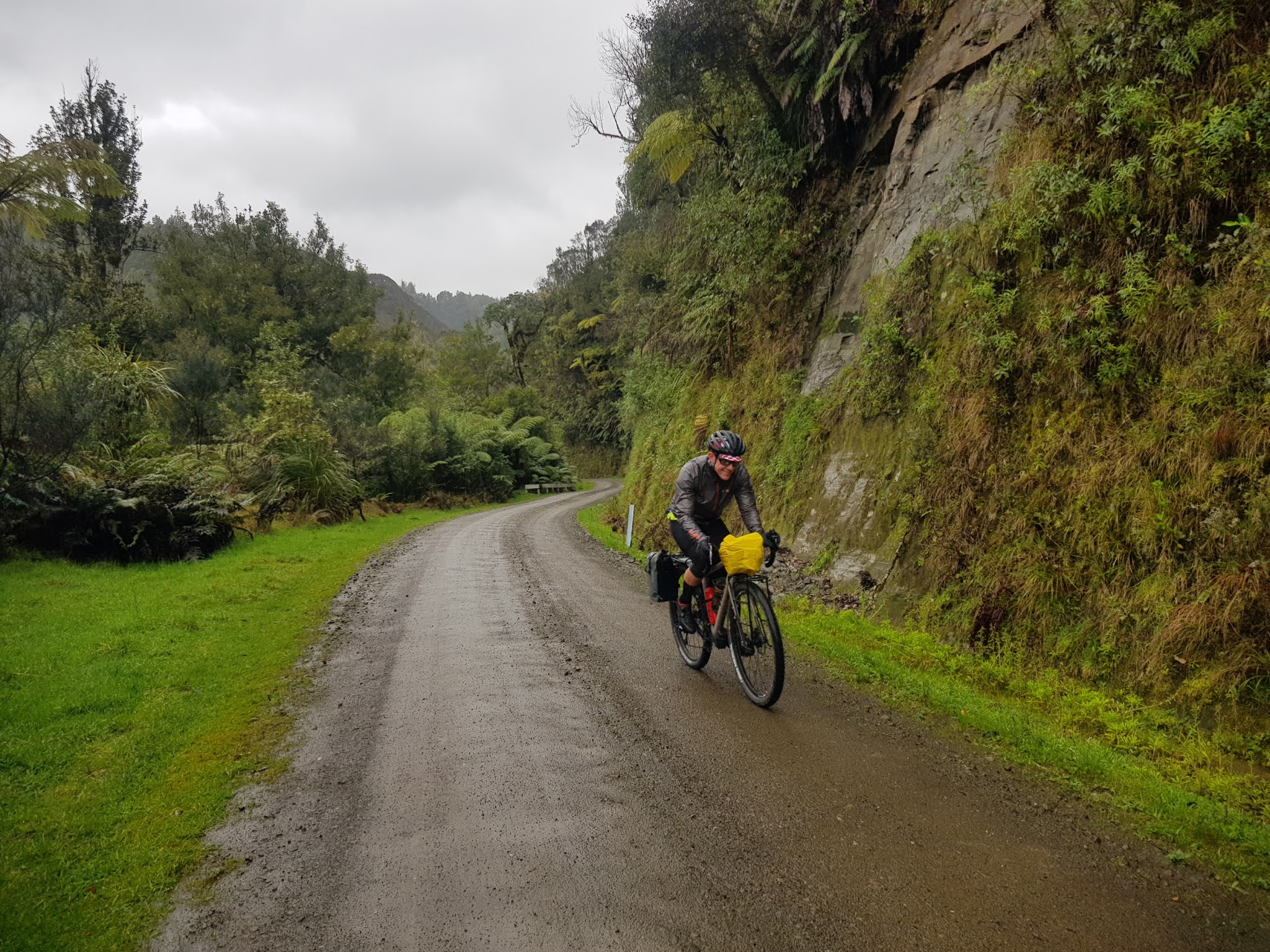
We managed to stay dry for the 5 minute ride into Stratford-central, but by the time we'd finished breakfast, ridden 5km on the main drag down to Midhurst, and jumped onto our first back roads, the weather had become pretty grim - wet, and about 8 degrees with a cold wind blowing.


Between the weather, a somewhat confusing road network, and my Garmin's unwillingness to show any roads on the map screen when the scale was any more than 300m per centimetre, I ended up taking us on a detour past Lake Ratapiko.  The lake itself was mighty scenic, and there looked to be a wee island with a homestead on it, but sadly the unnecessary 10km or so were probably not worth it.  Brendan was paying more attention to the wind direction than I, and detected we'd gone wrong soon enough to prevent us riding in a full circle.


Brendan had done a number of Tours of Taranaki over the years (typically a time trial plus three road stages), and soon after we turned onto Otaraoa Road alongside the Waitara River, he realised he would soon be passing through a hand-cut tunnel that he'd raced through years ago, and had never been able to work out where it had been.  It was a nice moment for him, I think, and fun to observe.  


After a bit of ducking and diving, we rejoined SH3 just before Urenui.  There, we had a number of cafes to choose from, and fortunately picked the one that had an open fire cranking (note to self:  look for smoke emitting chimneys when choosing a stop on a cold day...).  Since this was the only guaranteed mid-ride shop we would pass on our entire route, we made the most of it, and left feeling quite sated.


Once underway again, we had only a few minutes on the main drag before turning inland onto Okoki Road.  The seal lasted a short while, but soon we were onto gravel, and not long after that my drive train starting groaning.  


We stopped at the intersection with Uruti Road and a rinse with some of my drinking water and some fresh lube seemed to quieten my chain down a lot.  This happened to be where we got onto a section of road I'd ridden on day two of the second Tāwhio o Whanganui.  Uruti Tunnel was definitely familiar - who could forget it!

Uruti Tunnel


Out on the other side, a cheeky motorist had spun one of two speed limits around, but it was hard to tell which.


Our third tunnel of the day was the Moki Road tunnel...


... but it wasn't our last.  Part way along the gravelled Kiwi Road, we stopped to chat to a guy in a car.  He'd driven from Whanganui, via the River Road up to Raetihi, and then through Taumarunui, and on to the middle of nowhere.  While we were doing a very similar thing, it surprised us to think that someone would bother doing it alone, and in a city car.  


A sign near the beginning of Kiwi Road had understated the distance to SH3 by about 10km, but I'd found the riding otherwise great.  When we hit the sealed Okau Road, we turned left - the last time I'd been at this intersection, I'd turned right en route to Ohura.  That time, I'd been disappointed to miss out on the Okau Road tunnel, and while it was still cool to ride a bridge straight into a tunnel, in the intervening years, the road up Taroko Gorge in Taiwan had really upped the ante, and as a result, this was a bit of a let down...


We were feeling a tad weary when we reached SH3, and unfortunately, we had a nasty headwind for about 20km into Mokau.  By the time we reached our accommodation, the very lovely Mokau Motel, I was feeling pretty shot.  I was delighted to find the room came with a mini-bar of sorts, and I smashed back a choccy bar and can of coke that I could have done with 20km earlier, before jumping in the shower.

The Awakino Hotel sent a courtesy shuttle for us, which made for a very nice dinner, all the better to ride a long way the following day!  Had there been no shuttle, I'd have rather gone hungry than ridden my bike any further!  

Stats:  163km ridden.  Almost as many tunnels as cars off of SH3.  


Day 2 - Mokau to Te Kuiti

The next morning, our priorities were food and bike cleaning.  Our moteliers kindly donated an old t-shirt to assist with the latter task, while the convenience store at the bottom of the driveway had a more-than-capable coffee machine to help take the edge off the morning.  

After demolishing a big breakfast, I bought a couple of sandwiches for lunch further down the line.  


The road to Awakino passed by quickly, and a few kilometres up river, we turned left off SH3 onto Manganui Road.  Almost immediately we passed an intersection I'd been through before - Simon and I had dropped down to this point on a stunning bit of gravel road back in 2012.  My memories of the next 40 kilometres of road turned out to be very patchy, but I remember the quality of the company vividly.  

Notable highlights were the near complete absence of traffic, a quarry which looked to be systematically dismantling an entire hill, and sweet pockets of native bush.  Despite our overnight host's encouragement, and the apparently flat terrain out to Waikawau Beach and its resident (and intriguing) "stock tunnel", we weren't willing to add 10km to our day.  It gives a bloody good reason to go back, I suppose!


I'd completely forgotten the two saddles en route to our turn off onto Pomorangai Road, the point at which we deviated from Simon's and my parcours.  The road was briefly sealed, and after a quick stop to top up bottles, we were underway.


The road conditions were very slow going, and as we got further and further up the climb, they increasingly worsened.  It was clear someone was in the process of laying fresh gravel, and it seemed like the laden truck going up and down was the only form of compaction being undertaken.  Consequently, the surface got softer and softer, and it was a blessed relief to finally out-ride their effort.  Mercifully, the slop didn't seem to adhere to our tyres, so at least our bikes were relatively clean and unscathed.  


After some much faster travel, the road broke out of the native bush cover, and we had great views out to the north-east.  While we stood and admired them, a postie pulled up and made the most of the human interaction we provided.  His 6-hour daily route covered a very-remote 200km, and we suspected he had very little opportunity to chat to anyone while working.  

After a fun 10km descent, we stopped for a bite to eat, and soon after getting moving again were cowering in a wee shelter at the end of someone's driveway.  No sooner had we left there than the heavens really opened, replete with a very impressive thunder-clap which sounded like a train moving off into the the distance.  The sound effect was either a very unusual illusion, or indicated a very long and fast moving discharge up above.  

The road turned to seal around about the time we had a flurry of traffic, which, given the hour, Brendan suggested they were likely parents on a school-pickup run.  The conditions either side of the road changed too, and we passed many natural amphitheatres and cool rock outcrops.  


Oparure Road was lumpy as it took us across to SH3, just north of Te Kuiti.  After 500m on the main drag, we peeled off to connect with a back road which took us all the way into town, the centrepiece of which seems to be a massive railway yard.  

Stats:  110km ridden, about as many feral goats startled.  


Day 3 - Te Tuiti to Taumarunui

The Te Kuiti locals have a slow start on a Saturday morning, or at least their cafes do.  Nonetheless, we managed to get a decent breakfast at the large BP station, from which we quickly knocked out our final main-road kilometres of the trip.  


About 12km from Te Kuiti, we turned off SH3 onto SH4, and a couple of minutes later left that to begin one of the finest back-road sequences I've had the pleasure to ride.  The network was initially complex, but guided by the AA map, and some lucky choices, we navigated through to our main target, the Aria-Matiere Road.  

Aside from a few sealed kilometres on Tikitiki Road, we were treated to a really nice gravel surface, making for fast and stress-free riding.  The scenery was fantastic, and the gradients were incredibly mellow too - a 40km stretch was about as flat as you're likely to find in NZ, despite the road being surrounded by hills.  

We passed hundreds of turkeys, which typically gobbled at us as we rode past.  There were also occasional pheasants, who had this neat trick of gliding mid-flight, temporarily looking like an inanimate projectile.  Kererū were also pretty common, but the countryside definitely seemed to have been taken over by exotic birds.  

Morning tea at a saddle before dropping down to cross Mokauiti Rd

Eventually the road tipped up, and over the other side of a 5km climb, we stopped for lunch at a one-lane bridge.  Not only did the concrete curb make for a fine seat, but it was also bathed in sunshine, necessitating shedding of the knee warmers, one of the first times in months that I've ridden without them.  


Nearing Matiere, we opted not to cut across to Mangapapa Road, and instead took a chance with a longer route.  As a north-American might say, we "lucked out", and contrary to the apparent negative connotation, it was more of the same, glorious, easy-riding that we'd become accustomed to.  I'd been keen to prolong the gravel riding a bit longer, and we were both bloody glad that's exactly what we'd done.  


Matiere looked like a reasonably sized settlement, sitting on the main route to Ohura from the north.  Dave Sharpe and I had passed through here on Day 3 of the 2013 Tāwhio, though the riding conditions then were a far cry from those Brendan and I were being treated to.

A few minutes up the Okahukura Saddle Road, we passed a wee turnoff marked Otahu Road.  I think what made me stop and consult the map was that it didn't have "No Exit" showing.  My excitement grew when I noticed that despite the AA map not featuring the turn off we were at, it did have a short section of Otahu Road coming off Opotiki Road way above us, and I managed to convince Brendan to indulge my inquisitiveness.

A short way up the road we passed under the railway line, and not long after that the road shown on my GPS unit stopped.  We didn't though, until we came to a farm gate a few minutes later.  Access rights were unclear, but we had cell phone reception, allowing a spot of research.  


Determined to feel OK about pushing on, my internet research led me to walkingaccess.govt.nz, and a search in the "Public Access Areas Map" for Otahu Road, yielded the legal route we were hoping to find.


We made our way through the gate, but were soon staring up a steep fenceline and an unridable farm track, laughing at the warning we'd both seen on the walking access site:  "Please note that legal access is not necessarily practical to use."  All told, we lost about half an hour on this fool's errand, but the warm conditions, and unanimously pulling the pin before things got overly ridiculous helped avoid strife!

Our return to the "main" road signalled the permanent end of the day's gravel riding, but the climb dished out at least one reminder that the route we were taking had been around since long before the automobile, and tarmac.  


Once over the saddle, the descent took us down to SH4, and while Dave and I had ridden the highway into Taumarunui, I can only surmise the foul weather had discouraged us from crossing straight onto Ongarue Back Road, via a neat road/rail bridge.  (Warning to trains, while you can get over the river OK, someone has flogged the next bridge that used to get you over the highway.) 


Our sense of acceptable traffic volumes was completely out of whack, after a four-hour stretch with about a vehicle per hour.  On the "back road", we saw about a vehicle per minute or two, but nonetheless made it unscathed to our digs at the Forgotten World Motel, both fizzing on the back of a brilliant day of riding.  

Stats:  116 glorious kilometres, and more degrees than cars.  


Day 4 - Taumarunui to Whangamomona

Overnight, Brendan broached the issue of separating en route to Whangamomona.  I'd ridden "The Forgotten World Highway" direct route a couple of times, westwards on the first first Tāwhio, and eastwards with Simon a couple of years earlier on a cycle tour between New Plymouth and National Park.  Given that both times I'd been on a mountainbike, I was shocked to notice how many unsealed through routes there were off SH43, and was keen to check a few of them out.   Brendan, on the other hand, had a much heavier load, and wanted to make some use of the camera and tripod he'd been hauling, without frustrating me.  I wasn't hard to convince!

We'd availed ourselves of the New World across the road for breakfast supplies, and the well stocked kitchenette in our room to eat in, though after admiring the couple of dozen tuis gorging on a nearby tree, we went for second coffees in Maccas.  


After climbing out of Taumarunui on SH43, we dived off together onto Kururau Road, which didn't appear to add any distance to the main route to Whangamomona, definitely added to quality of the experience.  The road almost immediately turned to gravel and tipped up, affording us a lovely 30 minute climb to get the legs warm.  


Goats were yet again in abundance, and while I didn't stop to assist one whose short horns and poor technique were had its head trapped through a wire fence, Brendan reported doing so on his subsequent way past.  

What goes up, must come down, and as with the climb, the descent to the intersection with Whakamaro Road was wonderful.  After a few minutes on sealed road, we continued together on Kururao Road.  The surface deteriorated for a while, but soon we passed a grader sitting in a clearing, and beyond that travel became more enjoyable again.  


As we neared the terminus of Kururau Road on SH43, I heard sealant escaping from my rear tyre, and stopped to investigate,  I turned the bike upside down to find a hole just off centre on the fairly worn centreline of the smooth-by-design WTB Byway - time to use a tyre plug in anger for the first time.  

I'd thrown a Genuine Innovations repair kit into my Cyclewerks order at the last moment, and while I had never installed a tyre plug, understood the basic principle.  As I used the tool to push a "bacon strip" through the puncture, there was a gush of air signalling I'd made a small hole bigger, and I held my breath hoping that the combination of the plug and Stan's sealant would work their magic.  They seemed to be doing so as I trimmed off the excess plug as closely as I could to the tyre, using my Leatherman Squirt.  To be honest, I was sceptical that this would work, given that the plug would hit the ground on every single rotation of the wheel, but it seemed sensible to give it a whirl.

When I said goodbye to Brendan not 5 minutes later, initial signs were positive, albeit hardly a guarantee of ongoing success.  As the minutes and kilometres passed on Roto Road, my anxiety levels decreased.  I had three tubes and some old road racing tyre which I could use to reinforce the damaged part, but, there seemed to be a good chance it would be unnecessary.  Go the bacon strip!


I hadn't seen a vehicle since Taumarunui, and wondered if a woman going for a blat on a horse in an adjacent paddock counted as "oncoming traffic"?!  Another woman was walking her dogs on outskirts of Ohura.  Otherwise, the roads were deserted.

I was hoping to find two things in Ohura, and I wasn't disappointed.  The public loo even had its own NZ COVID Tracer QR code, and after availing myself of it, I returned to Fiesta Fare for a coffee and scone with jam and cream.  I lamented having hauled a couple of service station sandwiches this far, made worse when the fella after me ordered a pulled pork burrito!!


This was the "tyre's playing up" bail out point, whereupon I could have ridden sealed road most of the way to Whangamomona.  But, my tyre wasn't playing up at all, and both weather and legs were also behaving.  So, I set off over the "Waitangaas", as per the local parlance (minding my head as I went).


This was another bit of road I'd previously ridden, though in the opposite direction and some years ago.  Consequently, it wasn't overly familiar, and I enjoyed not knowing what was to come.  Once the main climb was over, I had about 20km of easy riding on great gravel before a stunning sealed descent.  Not long after that, I made my left turn onto Okau Road, not 4km upstream from where Brendan and I had emerged from Kiwi Road, a couple of days earlier.  


A signpost told me I had about 29km to ride to Tahora, a few kilometres beyond the intersection with SH43.  Initially, the gradient was very mellow, and followed a stream up the valley.  After curving around an escarpment, I could see ahead a tight switchback, and once around that all hell broke loose, and I had to muster all my reserves to stay on the bike.  The 1.3km long stretch of sealed road was a consistent gradient, but at 14% average, it still took me over 11 minutes to get up it!!

I bumped into a DOC ranger a couple of minutes later, which was a great excuse to stop and regather myself.  He recommended I take a short detour to see Mt Damper Falls, and when I got there, I bumped into a quartet of Sutherlands: Diana, Linda, Scott and Phil (brother of Chris) who recognised me.  While Brendan and I had been able to natter away on much of days 1-3, it was somewhat ironic to me that I'd had so many conversations while riding solo, in the middle of nowhere!


Mt Damper Falls was indeed worth the side trip, and I was really glad that I'd taken some time out.  They weren't quite as impressive as Bridal Veil Falls (about 210 kilometres ride north, visited with Simon), but still pretty majestic.


Sightseeing done, it was a fairly easy ride down to SH43, during which time I passed the other end of Moki Road, a spot that I'd almost visited about 20 years ago with Mike Lowrie, when we mountainbiked the "Mythical Moki" and Rerekapa Tracks (see Classic New Zealand Mountain Bike Rides, editions 1-9).


Once on SH43 itself, the remainder of the route was not only sealed, but covered fairly benign terrain, and it took me a little under an hour to reach the Whangamomona Hotel, where I found Brendan ensconced.  


While anticipating my arrival, he'd obviously told those in the pub which way I was coming, and I got a few respectful smiles, and a couple of thumbs up.  Before heading upstairs to shower, I celebrated my arrival with a beer and a mocha, and once cleaned up, a pulled pork burger.


We got to talking with the publicans and some locals after our meal, and got distracted from the dessert menu.  It was interesting to hear about the way of life well off the beaten track, and to hear that I'd ridden past a honey outfit that produces to the tune of 100 tonnes of honey a year from manuka and other natives downstream of Mt Damper Falls.  

Stats:  131km ridden.   More conversations than you could shake a stick at!


Day 5 - Whangamomona to Stratford

Two hunters had been in the bar the previous evening while we'd eaten, notable by their choice of drink - what looked like strawberry milk, but apparently laced with gin shots.  In any case, their handiwork was apparent when we went to collect our bikes in the morning.  


After two days of fine-weather riding, it was a shame to see the temperature had dropped again, and that wet shoes were certain.  Brendan had expressed a desire to get back to the car relatively quickly.  It was stressful to discover my legs had stayed in bed, and in hindsight, I had heavily dialled back the calorie intake after a long hard ride.  As we rolled out of Whangamomona, and I yoyoed off the back, I realised my brain was starting to get bogged down in the circumstances.


On the other hand, one of the upsides of wet shoes was one of the lowest altitude rainbows I've ever seen.  


We had a couple of short climbs, both sealed, and at the top of the second was the only diversion we'd not ruled out.  I was delighted that Brendan seemed keen, if only in the hope that getting a bit more gravel in might snap me out of my fretting.  Indeed it did, and after a bit more climbing, we bombed down to our turn onto Matai Road.  I was fairly certain I'd been through this intersection before, with Simon, Dave and Andrew McLellan en route to Ohura.  When we reached Kiore Tunnel not long afterwards, I knew for sure.  


We ignored a couple of roads that would have taken us back onto SH43. and as we neared Stratford, both the elements and the terrain seemed out to get us.  I felt a lot better once I'd put on my Ground Effect rain pants - even though my legs weren't feeling particularly cold, keeping the wind off them helped everything else warm up a bit.  The rain hadn't set in, and for a few moments we thought we might get a complete glimpse of Mount Taranaki, but alas, it wasn't to be.


We did eventually join The Forgotten World Highway a few miserable kilometres from Stratford.  As Brendan pointed out, we were essentially climbing a mountain, and in that respect, the horrible false flat made sense.  Still, it was a pretty shit way to finish an otherwise fantastic five day ride.

Stats:  72km ridden, fifth best ride of the 592km total.  


* * *

It was great to get away with Brendan, following our very enjoyable East Cape Tour of 2019, and particularly since a planned multi-day ride out of Dunedin at Easter had been scuppered by COVID.  We both agreed that the third day had been one for the books, with some great supporting acts either side.  Given our different preferences for Day 4, the split had been an easy call, and we were surely each better for it when we met up that evening.  

I was really pleased with the route - for a ride almost 600km long, we'd managed about 30km on SH3 on Day 1, 5km on Day 2, another dozen on Day 3, and about 500m on Day 5 - less than 50km in total.  The remaining roads had been gloriously remote, but had brought us to convenient and sufficiently well equipped overnight stops to better make the next day's ride well fuelled and enjoyable.   

We have very different approaches to packing.  Brendan's loaded bike was pretty hefty, with a couple of panniers and a handlebar bag, while my Open and gear probably didn't weigh any more than his burlier Trek 920 adventure touring bike and racks.  Nonetheless, we both seemed happy enough.  

My rig ran like a dream, and it was great that the tyre plug got me home without any fuss - the tyre's been binned now though.  It really is the bike of my dreams, and I can see myself clocking up some serious back country miles on it.  I read somewhere today an opinion that 50-34 compact road gearing is no good for gravel bikepacking, but I found it perfect, and never had to resort to a tactical walk.  The WTB Venture/Byway combo were pretty sweet too, and once the world gets back to stocking bike parts, I'll be ensuring I have a couple of spares.  

Sarah and I had a Christmas plan to ride the North Island route of the Tour Aotearoa, but having reviewed the course, and in particular the amount of sealed road riding, I'm inclined to stay west south of Auckland, and show Sarah some of these magnificent back-country roads.  

Bring it on.